North Ice
 From Handwiki
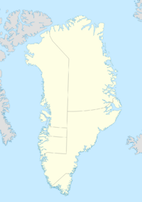
North Ice was a research station of the British North Greenland Expedition (1952 to 1954) on the inland ice of Greenland. The coordinates of the station were [ ⚑ ] 78°04′N 38°29′W / 78.067°N 38.483°W, at an altitude of 2,341 metres (7,680 ft) above sea level. The British North Greenland Expedition had its main base camp in Britannia Lake, Queen Louise Land.[1] It was led by Commander James Simpson RN. The station recorded a temperature of −66.1 °C (−87.0 °F) on 9 January 1954, which made it the lowest temperature ever recorded in North America up until that time. It was superseded by an observation of −69.6 °C (−93.3 °F) at the Greenland Ice Sheet on 22 December 1991.[2][3] The name of the station contrasts to the former British South Ice station in Antarctica.
[ ⚑ ] 78°04′N 38°29′W / 78.067°N 38.483°W
See also
- List of research stations in the Arctic
- Eismitte
- Summit Camp
- NEEM Camp
References
- ↑ Ice Recession in Dronning Louise Land, North-East Greenland
- ↑ "Western Hemisphere: Lowest Temperature". Arizona State University World Meteorological Organization. 2014. Archived from the original on 18 May 2013. https://web.archive.org/web/20130518042137/http://wmo.asu.edu/western-hemisphere-lowest-temperature. Retrieved 12 January 2014.
- ↑ WMO verifies -69.6°C Greenland temperature as Northern hemisphere record
 |  |
Categories: [Arctic research]
↧ Download as ZWI file | Last modified: 06/14/2024 07:50:30 | 1 views
☰ Source: https://handwiki.org/wiki/Earth:North_Ice | License: CC BY-SA 3.0