Charlier (Martian crater)
Topic: Astronomy
 From HandWiki - Reading time: 4 min
Short description: Crater on Mars
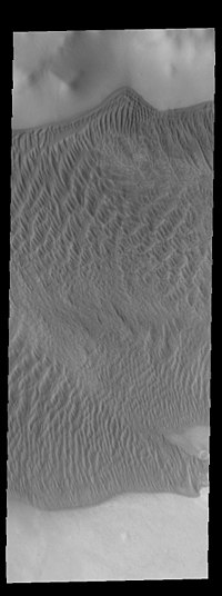
 THEMIS image of Charlier crater showing part of the large sand sheet with surface dune forms on the crater floor | |
| Planet | Mars |
|---|---|
| Region | Mare Australe quadrangle |
| Coordinates | Coordinates: 68°34′S 168°40′W / 68.56°S 168.67°W |
| Diameter | 106.28 km |
| Discoverer | Mariner 9 |
Charlier is a crater in the Mare Australe quadrangle of Mars. The crater is located at 68.56°S latitude and 168.67°W longitude. It is 106.28 km in diameter and was named after Carl Charlier, a Swedish astronomer. Its name was approved in 1973.[1]
See also
- List of craters on Mars: A-G
References
- ↑ "Charlier". Gazetteer of Planetary Nomenclature (USGS). International Astronomical Union. http://planetarynames.wr.usgs.gov/Feature/1154.
External links
Licensed under CC BY-SA 3.0 | Source: https://handwiki.org/wiki/Astronomy:Charlier_(Martian_crater)9 views | Status: cached on August 15 2022 12:47:57↧ Download this article as ZWI file
 KSF
KSF

