South (Martian crater)
Topic: Astronomy
 From HandWiki - Reading time: 6 min
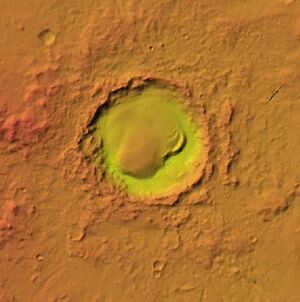 Topographic location map of South Crater | |
| Planet | Mars |
|---|---|
| Coordinates | [ ⚑ ] : 76°54′S 21°54′E / 76.9°S 21.9°E |
| Diameter | 101.84 km (63.28 mi) |
South is an impact crater in the Mare Australe quadrangle of Mars, located at 76.9°S latitude and 21.9°E longitude. It measures 101.84 kilometres (63.28 mi) in diameter, and was named after British astronomer Sir James South (1785–1867). The name was approved by the International Astronomical Union (IAU) Working Group for Planetary System Nomenclature in 1973.[1]
Description
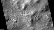
Very close to the crater there are what have been named "Swiss cheese" features. Swiss cheese features (SCFs) are pits so named because they look like the holes in Swiss cheese. They were first seen in 2000 using Mars Orbiter Camera imagery.[2] They are usually a few hundred meters across and 8 metres (26 ft) deep, with a flat base and steep sides. They tend to have similar bean-like shapes with a cusp pointing towards the south pole. The angle of the sun probably contributes to their roundness. Near the Martian summer solstice, the sun can remain continuously just above the horizon; as a result the walls of a round depression will receive more intense sunlight, and sublimate much more rapidly than the floor. The walls sublimate and recede, while the floor remains the same.[3][4]
As the seasonal frost disappears, the pit walls appear to darken considerably relative to the surrounding terrain. The SCFs have been observed to grow in size, year by year, at an average rate of 1 to 3 metres (3 ft 3 in to 9 ft 10 in), suggesting that they are formed in a thin layer (8 m or 26 ft) of carbon dioxide ice lying on top of water ice.[5][6]
Gallery
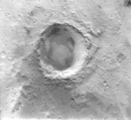
Viking Orbiter 2 image
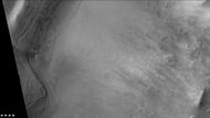
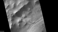
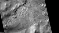
East side of South crater, as seen by CTX camera (on MRO).
See also
References
- ↑ International Astronomical Union (IAU) Working Group for Planetary System Nomenclature (WGPSN). "South on Mars". Gazetteer of Planetary Nomenclature. US Geological Survey. https://planetarynames.wr.usgs.gov/Feature/5656.
- ↑ Thomas, P. C. (March 2000). "North-south geological differences between the residual polar caps on Mars". Nature 404 (6774): 161–164. doi:10.1038/35004528. PMID 10724162. Bibcode: 2000Natur.404..161T.
- ↑ Hartmann, William K (2003). A Traveler's Guide to Mars. Workman Publishing.
- ↑ Mangold, Nicolas (2011). "Ice sublimation as a geomorphic process: A planetary perspective". Geomorphology 126 (1–2): 1–17. doi:10.1016/j.geomorph.2010.11.009. Bibcode: 2011Geomo.126....1M.
- ↑ Byrne, S.; Ingersoll, A. P. (2002). "A Sublimation Model for the Formation of the Martian Polar Swiss-cheese Features". AAS/Division for Planetary Sciences Meeting Abstracts (American Astronomical Society) 34: 837. Bibcode: 2002DPS....34.0301B.
- ↑ Russell, Patrick (26 September 2007). "South Pole Residual Cap Swiss-Cheese Terrain Monitoring". https://hirise.lpl.arizona.edu/PSP_005095_0935.
 |
 KSF
KSF