Ashford Caves
Topic: Earth
 From HandWiki - Reading time: 2 min
| Ashford Caves | |
|---|---|
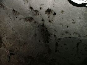
 Bats occupy several caverns in the caves complex. | |
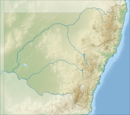
| Location | Ashford, New South Wales, Australia |
| Coordinates | [ ⚑ ] : 29°12′29″S 150°58′56″E / 29.20806°S 150.98222°E |
| Geology | Limestone |
| Access | Public |
| Show cave opened | 1915 |
| Show cave length | 560 metres (1,840 ft)[1] |
The Ashford Caves, located within the Kwiambal National Park, are a series of caves that contain an outcrop of coralline limestone and are located in the New England Northern Tablelands region of New South Wales, in eastern Australia . The caves are managed by the NSW National Parks & Wildlife Service and are situated approximately 8 kilometres (5.0 mi) west of the former Ashford coal mine, north of Ashford and not far from the Queensland border town of Template:QLDcity.
Originally on a private property, the Ashford Caves are now part of the Kwiambal National Park. A basic camping ground called 'Lemon Tree Flat' is located within a 10-kilometre (6.2 mi) radius of the cave entrance, as are the Macintyre Falls.[2]
The large arch-shaped opening was made to access the phosphate (guano) resources for use as fertilizer, which has been quite profitable. Prospects of mining limestone at this location have been explored, but dismissed as unviable.
A colony of Eastern Bent-wing Bats[3] inhabits the cave system and breeds from November through March.
See also
- List of caves in New South Wales
References
- ↑ Guide to New South Wales Karst and Caves (PDF) (First; revised ed.). Government of New South Wales. June 2011. p. 10. ISBN 978-1-74232-547-7. http://www.environment.nsw.gov.au/resources/geodiversity/110455nswkarstcaveguide.pdf#12.
- ↑ "Inverell Online". http://www.inverell.nsw.gov.au/dir205/InvOnline.nsf. www.inverell.nsw.gov.au
- ↑ "Threatened species: Eastern bentwing bat". Office of Environment & Heritage. Government of New South Wales. http://www.threatenedspecies.environment.nsw.gov.au/tsprofile/profile.aspx?id=10534.
 |
 KSF
KSF
