Table of Contents Categories
Cape (geography)
Topic: Earth
 From HandWiki - Reading time: 5 min
Short description: Large headland extending into a body of water, usually the sea


In geography, a cape is a headland, or peninsula or promontory extending into a body of water, usually the sea.[1] A cape usually represents a marked change in trend of the coastline, often making them important landmarks in sea navigation. This also makes them prone to natural forms of erosion, mainly tidal actions, resulting in a relatively short geological lifespan. Capes can be formed by glaciers, volcanoes, and changes in sea level. Erosion plays a large role in each of these methods of formation.[citation needed]
Gallery
-
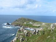 Cape Cornwall, England
 -
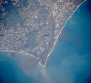 Satellite image of Cape Fear, North Carolina
 -
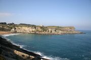
 Cape MacLear, Malawi
 -
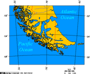 Map depicting Cape Horn at the southernmost portion of South America
 -
 Photograph of Cabo Mayor in Santander, Spain
 -
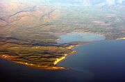 Photograph of Cape Cambell, New Zealand, at sunrise


.jpg)


See also
- Extreme points of Africa
- Extreme points of Asia
- Extreme points of Europe
- Extreme points of North America
- Extreme points of South America
References
- ↑ Whittow, John (1984). Dictionary of Physical Geography. London: Penguin, 1984, p. 80. ISBN 0-14-051094-X.
External links


 |  |
Licensed under CC BY-SA 3.0 | Source: https://handwiki.org/wiki/Earth:Cape_(geography)87 views | Status: cached on June 26 2026 04:41:41↧ Download this article as ZWI file
 EncycloReader
is supported by the
EncycloReader
is supported by the