San Carlos (Equatorial Guinea)
Topic: Earth
 From HandWiki - Reading time: 1 min
| San Carlos | |
|---|---|
| Gran Caldera de Luba | |
| Highest point | |
| Elevation | 2,261 m (7,418 ft) [1] |
| Prominence | 1,539 m (5,049 ft) [2] |
| Listing | Ultra |
| Coordinates | [ ⚑ ] : 03°21′39″N 08°32′21″E / 3.36083°N 8.53917°E [1] |
| Geography | |
| Location | Bioko, Equatorial Guinea |
| Geology | |
| Mountain type | Shield volcano |
| Last eruption | Unknown |
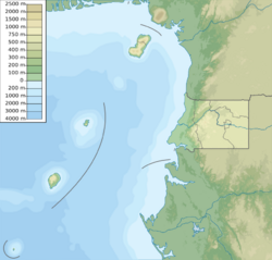
San Carlos (also Gran Caldera de Luba, or simply Caldera) is a basaltic shield volcano with a broad summit caldera on the island of Bioko, Equatorial Guinea.[3] With an elevation of 2,261 metres above sea level it is the second highest peak in Equatorial Guinea.
See also
- Luba Crater Scientific Reserve
- List of Ultras of Africa
References
- ↑ 1.0 1.1 "Africa Ultra-Prominences". Peaklist.org. http://peaklist.org/WWlists/ultras/africa.html. Retrieved 2014-05-13. Listed as "Gran Caldera de Luba"
- ↑ "Gran Caldera de Luba, Equatorial Guinea". http://www.peakbagger.com/peak.aspx?pid=13064.
- ↑ "San Carlos". Smithsonian Institution. https://volcano.si.edu/volcano.cfm?vnum=224002.
 |
Licensed under CC BY-SA 3.0 | Source: https://handwiki.org/wiki/Earth:San_Carlos_(Equatorial_Guinea)6 views | Status: cached on August 15 2024 15:20:14↧ Download this article as ZWI file
 KSF
KSF
