6th of October (city)
Topic: Place
 From HandWiki - Reading time: 6 min
6th of October السادس من أكتوبر ستة اكتوبر | |
|---|---|
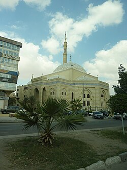 Al-Hosary Mosque | |
Location in Egypt | |
| Coordinates: [ ⚑ ] : 29°59′N 30°58′E / 29.983°N 30.967°E | |
| Country | |
| Governorate | Giza |
| Founded | 1979 |
| Named for | 1973 Arab–Israeli War |
| Area | |
| • Total | 88.0 sq mi (227.8 km2) |
| Population (2021)[1] | |
| • Total | 207,505 |
| • Density | 2,400/sq mi (910/km2) |
| Time zone | UTC+2 (EET) |
6th of October (Arabic: السادس من أكتوبر Al Sādis Min Uktōber; Egyptian Arabic: ستة اكتوبر Setta Oktōbar) is a city in the Giza Governorate of Egypt. It is a satellite city, located adjacent to Giza, and is part of the Greater Cairo region.[2] Per the 2017 national census, it had a population of 450,000 people.[3]
The city served as the capital of the now-defunct 6th of October Governorate, which was dissolved in 2011. Established as a new city in the desert,[4] it hosts many local students, as well as foreign students from the Persian Gulf Arab states, Jordan, Nigeria, Cameroon, Syria, Iraq and the Palestinian territories. The city is named for the day that the 1973 Arab–Israeli War broke out.
History
The settlement was established in 1979 by the 504th presidential decree of Egyptian President Anwar Sadat. It is 32 km (20 mi) from the center of Cairo and 17 km (11 mi) from the great pyramids of Giza. Despite having many unfinished or vacant buildings, the city has a total area of 482 km2 (119,000 acres) and is eventually expected to have 6 million residents.[5]
It was announced as the capital of the 6th of October Governorate in April 2008. Following the governorate's dissolution in April 2011, in the wake of the Egyptian revolution, it was reincorporated into the Giza Governorate, to which it had originally belonged.
The city's name commemorates the commencement of the 1973 Arab–Israeli War on 6 October 1973, the same date chosen as Egypt's Armed Forces Day.
Climate
Köppen-Geiger climate classification system classifies its climate as hot desert (BWh). Its climate is very similar to Giza and Cairo, owing to its proximity to them. that being said, some places in 6th of October is a bit colder and windier than central Cairo and Giza city at night for several reasons. This is mainly because buildings as infrastructure tend to be more spaced out accompanied by more empty spaces allows for wind to pick for easily than the densely populated centre of Giza and Cairo. Additionally, the city was built in the desert which tends to be colder and drier than the damp humid area closer to the Nile.
Script error: No such module "weather box".
Headquarters
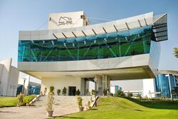
6th of October is the headquarters of the Confederation of African Football. It hosts Egypt's Smart Village, the technology park and regional hub for many companies in the IT and financial sectors.[citation needed]
The main office of the UNHCR in Egypt, in addition to its RSD office, is located in that city as well.[7]
Business
6th of October City has one of the largest industrial zones in Egypt, on which the entire city was established. The industrial zone provides jobs for employees within the city as well as from other parts of Giza. It is accompanied by a banking sector that groups branches of all banks in Egypt in an area that is close to the industrial area to serve the needs of the industry and residents.
Some of the largest businesses in 6th of October City are mentioned below:
- Bavarian Auto Group[8]
- Egyptian German Automotive Company
- General Motors Egypt[9]
- Shaer Consult Consultant Engineers
- Seoudi Group[10]
- Stream Global Services
- Vodafone Egypt
Industry
6th of October Airport is used for the transport of products and materials to and from the city. The city also houses four industrial zones.
Important factories:
- IGA Egyptian-German Car Factory
- Suzuki Egypt[11]
- Juhayna Food Industries
- Daewoo Motors Egypt
- Style Team Lighting
- Franke Kitchen Systems Egypt
- Pepsico Egypt
- Aller Aqua Factory[12][13]
Education facilities
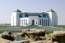
There are seven private universities in 6th of October City, including two private medical schools at Misr University for Science and Technology and October 6 University.
Universities and Institutes
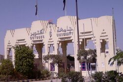
- Ahram Canadian University (ACU)
- Akhbar El Youm Academy
- Cairo University (CU) in Sheikh Zayed City
- Culture & Science City
- Egyptian Aviation Academy (EAA)
- Higher Institute of Applied Arts
- Higher Institute for Architecture
- Higher Institute of Engineering
- Higher Institute of Science and Technology
- Higher Technological Institute
- Pyramids Higher Institute for Engineering and Technology
- Misr University for Science and Technology (MUST)
- Modern Sciences and Arts University (MSA)
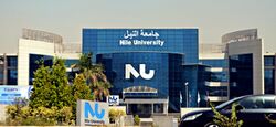
- Nile University (NU)
- New Giza University (NGU)
- October 6 University (O6U)
- Zewail City of Science and Technology
- Arab Academy for Science, Technology & Maritime Transport
- Information Technology Institute[14]
Secondary schools and international schools
- American International School in Egypt West Campus - Sheikh Zayed City[15]
- Beverly Hills Schools
- British International School in Cairo[16]
- International School of Choueifat 6th of October City[17]
- Heritage International School[18]
- 6th of October Stem school
- City Language School[19]
- Hossary-Azhari Language School[20]
Health services
- Dar Al Fouad Hospital, the first accredited cardiac hospital in Africa and the Middle East
- Misr University for Science and Technology (Souad Kafafi Memorial) Hospital
- October 6 University Teaching Hospital
Religion
Islam
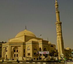
The city is served by many mosques, the largest being El Hosary Mosque on El Tahrir St. built in the honour of an eminent Egyptian Qari, Mahmoud Khalil Al-Hussary.
Christianity
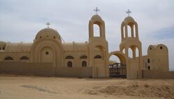
There are several churches in 6th of October city. The most famous of them is Redeem Christian Church of God (RCCG).
See also
- Dreamland
- Sheikh Zayed City
- Smart Village Egypt
- Greater Cairo
- Haram City
- New Borg El Arab
- 10th of Ramadan (city)
- List of cities and towns in Egypt
References
- ↑ 1.0 1.1 "Madīnat Sittah Uktūbar 2 (Kism (fully urban), Egypt) - Population Statistics, Charts, Map and Location". https://citypopulation.de/en/egypt/admin/al_j%C4%ABzah/2121__mad%C4%ABnat_sittah_ukt%C5%ABbar_2/.
- ↑ "To Catch Cairo Overflow, 2 Megacities Rise in Sand" article by Thanassis Cambanis in The New York Times August 24, 2010. Retrieved August 25, 2010.
- ↑ Central Agency for Public Mobilisation and Statistics (CAPMAS) (2017). "2017 Census for Population and Housing Conditions". https://www.cedejcapmas.org/adws/app/4d5b52dc-669d-11e9-b6a6-975656a88994/index.html.
- ↑ Neil MacFarquhar, David Rohde, Aram Roston: Mubarak Family Riches Attract New Focus. The New York Times, February 12, 2011, retrieved February 13, 2011
- ↑ "6th October City". http://www.newcities.gov.eg/english/New_Communities/October/default.aspx.
- ↑ "Climate: 6th of October - Climate graph, Temperature graph, Climate table". Climate-Data.org. http://en.climate-data.org/location/3677/.
- ↑ "Contact us — UNHCR Egypt". https://www.unhcr.org/eg/about-us/contact-us.
- ↑ "Contact Bavarian Auto Group". Bag-eg.com. http://www.bag-eg.com/ContactUs.aspx.
- ↑ Satyam. "Welcome to GMArabia Corporate Information". Gmegypt.com. http://www.gmegypt.com/content_data/LAAM/ME/en/GBPME/999/EG/index.html?cntryCd=EG&referrer=&pdcmp=.
- ↑ "Seoudi Group 1001 opportunities for investment in Egypt and Arab World". Seoudi.com. http://www.seoudi.com/.
- ↑ "SUZUKI EGYPT SAE". https://www.dnb.com/business-directory/company-profiles.suzuki_egypt_sae.fa436ce7e9aff1e972b583c7f1b55d31.html.
- ↑ "Aller Aqua Factories and Sales Offices". http://www.aller-aqua.com/about-aller-aqua/factories-and-sales-offices.
- ↑ "New Egyptian Factory Press Release". http://www.aller-aqua.com/about-aller-aqua/press/inauguration-of-new-egyptian-factory.
- ↑ Information Technology Institute
- ↑ "Home." American International School in Egypt West Campus. Retrieved on January 25, 2015. "AMERICAN INTERNATIONAL SCHOOL IN EGYPT WEST CAMPUS Sheikh Zayed City Entrance 2 Greens Compound"
- ↑ "Contact Us." British International School in Cairo. Retrieved on 23 January 2015. "Physical Address: Km 38, Cairo-Alexandria Desert Road, Beverly Hills, 6th of October City, Egypt, 12451" - See map
- ↑ "Contact Us." International School of Choueifat 6th of October City. Retrieved on 24 January 2015. "The International School of Choueifat - City of 6 October, Egypt Dreamland, City of 6 October, Al Giza, Egypt"
- ↑ "Heritage International School". http://www.heritageinternationalschool.com/.
- ↑ "City Language Schools". http://cityschools.edu.eg/index.aspx.
- ↑ "Hossary Language School". https://m.facebook.com/Hossary.Azhar.Language.School/.
 |
 KSF
KSF