Antsirabe II District
 From Wikipedia - Reading time: 5 min
Antsirabe II | |
|---|---|
District | |
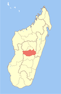
 Location of the district within the region of Vakinankaratra. | |
| Coordinates: 19°52′8.184″S 47°8′54.384″E / 19.86894000°S 47.14844000°E | |
| Country | |
| Region | Vakinankaratra |
| Area | |
• Total | 2,471.31 km2 (954.18 sq mi) |
| Population (2020) | |
• Total | 475,556 |
| • Density | 190/km2 (500/sq mi) |
Antsirabe II is a rural district in Vakinankaratra Region, Madagascar. The district surrounds the urban district and city of Antsirabe. It also borders the district of Faratsiho to the north, Antanifotsy to the east and Betafo to the west, in addition to the region of Antanifotsy to the south. The district covers a total area of 2,471.31 km2, with a population estimated at 475,556 in 2020.[1][2]
Communes
[edit]The district is further divided into 18 communes:
- Alakamisy
- Ambano
- Ambatomena
- Ambohibary
- Ambohidranandriana
- Ambohimiarivo
- Ambohitsimanova
- Andranomanelatra
- Antanambao
- Antanimandry
- Antsoatany
- Belazao
- Ibity
- Manandoana
- Mandrosohasina
- Mangatano
- Sahanivotry Mandona
- Soanindrariny
- Tsarahonenana Sahanivotry
- Vinaninkarena
References
[edit]- ^ Institut National de la Statistique, Anananarivo.
- ^ "Madagascar: Administrative Division (Regions and Districts) - Population Statistics, Charts and Map". www.citypopulation.de. Retrieved 2024-01-17.
Capital: Antsirabe | ||
| Ambatolampy (19) |
|  |
| Antanifotsy (14) |
| |
| Antsirabe I (1) |
| |
| Antsirabe II (20) |
| |
| Betafo (18) |
| |
| Faratsiho (9) |
| |
| Mandoto (9) |
| |
7 districts; 89 communes | ||
This Vakinankaratra location article is a stub. You can help Wikipedia by expanding it. |
This article is licensed under CC BY-SA 3.0.
Original source: https://en.wikipedia.org/wiki/Antsirabe II District
Status: article is cached
Original source: https://en.wikipedia.org/wiki/Antsirabe II District
Status: article is cached
 EncycloReader
is supported by the
EncycloReader
is supported by the