Dołhobrody
 From Wikipedia - Reading time: 4 min
Dołhobrody | |
|---|---|
Village | |
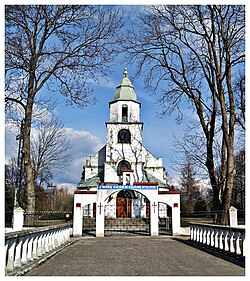 Church of Saint Stanislaus | |
 Dołhobrody | |
| Coordinates: 51°41′N 23°31′E / 51.683°N 23.517°ECoordinates: 51°41′N 23°31′E / 51.683°N 23.517°E | |
| Country | |
| Voivodeship | Lublin |
| County | Włodawa |
| Gmina | Hanna |
| Population | |
| • Total | 595 |
Dołhobrody [dɔu̯xɔˈbrɔdɨ] is a village in the administrative district of Gmina Hanna, within Włodawa County, Lublin Voivodeship, in eastern Poland, close to the border with Belarus. It lies approximately 15 kilometres (9 mi) north of Włodawa and 82 km (51 mi) north-east of the regional capital Lublin.[1]
The village has a population of 595 as of 2011. According to the National Census of Population and Housing 53.6% of the population are female and 46.4% male. [2]
References[edit]
- ^ "Central Statistical Office (GUS) - TERYT (National Register of Territorial Land Apportionment Journal)" (in Polish). 2008-06-01.
- ^ "Wieś Dołhobrody (Lubelskie) » mapy, GUS, nieruchomości, regon, kod pocztowy, atrakcje, wypadki drogowe, kierunkowy, edukacja, demografia, tabele, zabytki, statystyki, drogi publiczne, liczba ludności".
Gmina Hanna | ||
|---|---|---|
| Seat |
| |
| Other villages |
| |
This Włodawa County location article is a stub. You can help Wikipedia by expanding it. |
This article is licensed under CC BY-SA 3.0.
Original source: https://en.wikipedia.org/wiki/Dołhobrody
Status: article is cached
Original source: https://en.wikipedia.org/wiki/Dołhobrody
Status: article is cached
 EncycloReader
is supported by the
EncycloReader
is supported by the