Jalogny
 From Wikipedia - Reading time: 8 min
Jalogny | |
|---|---|
Commune | |
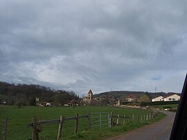 A general view of Jalogny | |
Location of Jalogny  | |
 Jalogny  Jalogny | |
| Coordinates: 46°25′11″N 4°37′53″E / 46.4197°N 4.6314°E | |
| Country | France |
| Region | Bourgogne-Franche-Comté |
| Department | Saône-et-Loire |
| Arrondissement | Mâcon |
| Canton | Cluny |
| Area 1 | 10.15 km2 (3.92 sq mi) |
| Population (Jan. 2020)[1] | 396 |
| • Density | 39/km2 (100/sq mi) |
| Time zone | UTC+01:00 (CET) |
| • Summer (DST) | UTC+02:00 (CEST) |
| INSEE/Postal code | 71240 /71250 |
| Elevation | 242–480 m (794–1,575 ft) (avg. 200 m or 660 ft) |
| 1 French Land Register data, which excludes lakes, ponds, glaciers > 1 km2 (0.386 sq mi or 247 acres) and river estuaries. | |
Jalogny (French pronunciation: [ʒalɔɲi]) is a commune in the Saône-et-Loire department in the region of Bourgogne-Franche-Comté in eastern France.
Geography[edit]
The Grosne forms most of the commune's southeastern border.
See also[edit]
- Communes of the Saône-et-Loire department
References[edit]
- ^ "Populations légales 2020". The National Institute of Statistics and Economic Studies. 29 December 2022.
Wikimedia Commons has media related to Jalogny.
| |
|
This Saône-et-Loire geographical article is a stub. You can help Wikipedia by expanding it. |
This article is licensed under CC BY-SA 3.0.
Original source: https://en.wikipedia.org/wiki/Jalogny
Status: article is cached
Original source: https://en.wikipedia.org/wiki/Jalogny
Status: article is cached
 EncycloReader
is supported by the
EncycloReader
is supported by the