Mongkung State
 From Wikipedia - Reading time: 5 min
| Mongkung (Möngküng) | |||||||||
|---|---|---|---|---|---|---|---|---|---|
| State of the Shan States | |||||||||
| 1835–1959 | |||||||||
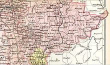 Möng Kung State in an Imperial Gazetteer of India map | |||||||||
| Area | |||||||||
• 1901 | 2,650 km2 (1,020 sq mi) | ||||||||
| Population | |||||||||
• 1901 | 30482 | ||||||||
| History | |||||||||
• State founded | 1835 | ||||||||
• Abdication of the last Saopha | 1959 | ||||||||
| |||||||||
Mongkung (also spelt Möngküng), also known as Maingkaing (Burmese: မိုင်းကိုင်), was a Shan state in what is today Burma. It belonged to the Eastern Division of the Southern Shan States. Its capital was Mong Kung, in the valley of the Nam Teng. The largest minority were Palaung people.
History[edit]
Mongkung state was founded in ancient times as Langkavadi. In 1835, after the British annexed Upper Burma and established their rule in the region, Mongkung had been formerly a feudatory state of Hsenwi.[1]
Rulers[edit]
The rulers of Mongkung bore the title Myoza in 1835-54 and 1863–73; Saopha in 1854-63 and from 1873.[2]
Saophas and Myozas[edit]
- 1835 - 1860 Hkun Long (d. 1860)
- 1860 - 1863 Hkun Long II
- 1863 - 1873 Gu Na (d. 1873)
- 1873 - 1879 Hkun San Kwan
- 1879 - .... Hkun Mong (b. 1873 - d. ....)
- 1879 - 1883 Heng Hkon Sang -Regent
References[edit]
External links[edit]
- "Gazetteer of Upper Burma and the Shan states"
- The Imperial Gazetteer of India
- "WHKMLA : History of the Shan States". 18 May 2010. Retrieved 21 December 2010.
21°36′N 97°31′E / 21.600°N 97.517°E
This Burmese history article is a stub. You can help Wikipedia by expanding it. |
This Shan State location article is a stub. You can help Wikipedia by expanding it. |
Original source: https://en.wikipedia.org/wiki/Mongkung State
Status: article is cached
 EncycloReader
is supported by the
EncycloReader
is supported by the