Mueang Sukhothai district
 From Wikipedia - Reading time: 6 min
Mueang Sukhothai
เมืองสุโขทัย | |
|---|---|
District | |
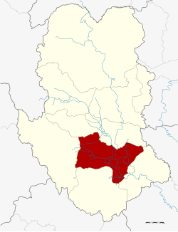 District location in Sukhothai province | |
| Coordinates: 17°0′28″N 99°49′23″E / 17.00778°N 99.82306°E | |
| Country | Thailand |
| Province | Sukhothai |
| Seat | Sukhothai Thani |
| Area | |
• Total | 581.5 km2 (224.5 sq mi) |
| Population (2008) | |
• Total | 106,397 |
| • Density | 185.0/km2 (479/sq mi) |
| Time zone | UTC+7 (ICT) |
| Postal code | 64000 |
| Geocode | 6401 |
Mueang Sukhothai (Thai: เมืองสุโขทัย, pronounced [mɯ̄a̯ŋ sù.kʰǒː.tʰāj]) is the capital district (amphoe mueang) of Sukhothai province, northern Thailand.
Geography
[edit]Neighboring districts are (from the southeast clockwise) Kong Krailat, Khiri Mat, Ban Dan Lan Hoi and Si Samrong of Sukhothai Province and Phrom Phiram of Phitsanulok province.
The important water resource is the Yom River.
History
[edit]Originally named Mueang as the capital district of Sukhothai Province, in 1917 the district was renamed Thani (ธานี).[1] In 1932, the province Sukhothai was abolished and merged into Sawankhalok Province.[2] In 1939 the province was renamed Sukhothai, and the district, by then named Sukhothai Thani (สุโขทัยธานี) was renamed Mueang Sukhothai.[3]
Administration
[edit]The district is divided into 10 sub-districts (tambons), which are further subdivided into 98 villages (mubans). The town (thesaban mueang) Sukhothai Thani covers tambon Thani. There are a further two sub-district municipalities (thesaban tambon): Ban Suan and Mueang Kao, each covering parts of the same-named tambons. There are a further nine tambon administrative organizations (TAO).
| No. | Name | Thai | Villages | Pop.[4] |
|---|---|---|---|---|
| 1. | Sukhothai Thani | ธานี | None | 16,479 |
| 2. | Ban Suan | บ้านสวน | 14 | 14,249 |
| 3. | Mueang Kao | เมืองเก่า | 11 | 17,482 |
| 4. | Pak Khwae | ปากแคว | 9 | 9,195 |
| 5. | Yang Sai | ยางซ้าย | 12 | 9,749 |
| 6. | Ban Kluai | บ้านกล้วย | 14 | 17,270 |
| 7. | Ban Lum | บ้านหลุม | 9 | 8,988 |
| 8. | Tan Tia | ตาลเตี้ย | 11 | 4,245 |
| 9. | Pak Phra | ปากพระ | 10 | 3,695 |
| 10. | Wang Thong Daeng | วังทองแดง | 8 | 5,045 |
References
[edit]- ^ ประกาศกระทรวงมหาดไทย เรื่อง เปลี่ยนชื่ออำเภอ (PDF). Royal Gazette (in Thai). 34 (ก): 40–68. 1917-04-29. Archived from the original (PDF) on November 7, 2011.
- ^ พระบรมราชโองการ ประกาศ ยุบรวมท้องที่บางมณฑลและบางจังหวัด (PDF). Royal Gazette (in Thai). 48 (ก): 576–578. 1932-02-21. Archived from the original (PDF) on April 9, 2008.
- ^ พระราชกฤษฎีกาเปลี่ยนนามจังหวัดและอำเภอบางแห่ง พุทธศักราช ๒๔๘๒ (PDF). Royal Gazette (in Thai). 56 (ก): 351–353. 1939-04-17. Archived from the original (PDF) on April 9, 2008.
- ^ "Population statistics 2008". Department of Provincial Administration. Archived from the original on 2009-08-20.
External links
[edit]- amphoe.com (Thai)
Districts of Sukhothai | ||
|---|---|---|
|  | |
This Sukhothai Province location article is a stub. You can help Wikipedia by expanding it. |
Original source: https://en.wikipedia.org/wiki/Mueang Sukhothai district
Status: article is cached
 EncycloReader
is supported by the
EncycloReader
is supported by the