Pantelej
 From Wikipedia - Reading time: 6 min
Pantelej
Пантелеј | |
|---|---|
City municipality | |
| City municipality of Pantelej Градска општина Пантелеј | |
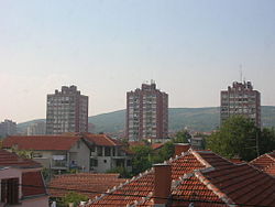 Panorama of some of Pantelej's neighborhoods | |
 Coat of arms | |
 Location of the municipality of Pantelej within City of Niš | |
| Country | |
| Region | Southern and Eastern Serbia |
| District | Nišava |
| City | Niš |
| Settlements | 14 |
| Government | |
| • Mayor | Nataša Stanković (SNS) |
| Area | |
| • Municipality | 140.97 km2 (54.43 sq mi) |
| Population (2011 census)[2] | |
| • Urban | 34,724 |
| • Municipality | 53,486 |
| Time zone | UTC+1 (CET) |
| • Summer (DST) | UTC+2 (CEST) |
| Postal code | 18000 |
| Area code | +381(0)18 |
| Car plates | NI |
| Website | www.pantelej.org.rs |
Pantelej (Serbian Cyrillic: Пантелеј) is one of five city municipalities which constitute the city of Niš. According to the 2011 census, the municipality has a population of 53,486 inhabitants.
Geography[edit]
The municipality borders Crveni Krst municipality in the west, Svrljig municipality in the north, Niška Banja municipality in the south-east, and Medijana municipality in the south.
Demographics[edit]
According to the 2011 census, the municipality had a population of 53,486 inhabitants, with 34,724 in the eponymous settlement.
Settlements[edit]
The municipality consists of 14 settlements, all of which are classified as rural, except for Pantelej, which is a part of a larger urban settlement of Niš.[3]
|
|
Neighbourhoods[edit]
- Pantelej
- Jagodin Mala (partly)
- Durlan
- Vrežina
- Čalije
- Somborska
- Durlan 2
- Durlan 3
See also[edit]
- Subdivisions of Serbia
- Niš
References[edit]
- ^ "Municipalities of Serbia, 2006". Statistical Office of Serbia. Retrieved 2010-11-28.
- ^ "2011 Census of Population, Households and Dwellings in the Republic of Serbia: Comparative Overview of the Number of Population in 1948, 1953, 1961, 1971, 1981, 1991, 2002 and 2011, Data by settlements" (PDF). Statistical Office of Republic Of Serbia, Belgrade. 2014. ISBN 978-86-6161-109-4. Retrieved 2014-06-27.
- ^ "Statute of the City Municipality of Pantelej" (PDF). May 25, 2017. Retrieved July 15, 2020.
External links[edit]
Wikimedia Commons has media related to Pantelej (Niš).
Municipalities and cities of Southern and Eastern Serbia | ||
|---|---|---|
| Cities |
|  |
| Municipalities |
| |
Coordinates: 43°20′13″N 21°54′47″E / 43.33694°N 21.91306°E
This article is licensed under CC BY-SA 3.0.
Original source: https://en.wikipedia.org/wiki/Pantelej
Status: article is cached
Original source: https://en.wikipedia.org/wiki/Pantelej
Status: article is cached
 EncycloReader
is supported by the
EncycloReader
is supported by the