R-3 regional road (Montenegro)
 From Wikipedia - Reading time: 7 min
 | ||||
|---|---|---|---|---|
| Regionalni put R-3 | ||||
 | ||||
| Route information | ||||
| Length | 40.3 km (25.0 mi) | |||
| Major junctions | ||||
| South-East end | ||||
| North-West end | ||||
| Location | ||||
| Country | Montenegro | |||
| Municipalities | Pljevlja | |||
| Highway system | ||||
| ||||
| ||||
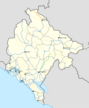
R-3 regional road (Montenegrin: Regionalni put R-3) is a Montenegrin roadway.[1]
It serves as connection between Pljevlja and Bosnia and Herzegovina.
History
[edit]In January 2016, the Ministry of Transport and Maritime Affairs published bylaw on categorisation of state roads.[1] With new categorisation, new R-3 regional road on this route was established from previous municipal road.
Major intersections
[edit]| Municipality | Location | km | mi | Destinations | Notes |
|---|---|---|---|---|---|
| Pljevlja | Pljevlja | 0.0 | 0.0 | ||
| Dajevića Han | 4.3 | 2.7 | |||
| Metaljka | 16.1 | 10.0 | Border crossing with Bosnia and Herzegovina | ||
| 1.000 mi = 1.609 km; 1.000 km = 0.621 mi | |||||
References
[edit]- ^ a b "Pravilnik o kategorizaciji državnih puteva" [Regulation on categorisation of state roads]. www.sluzbenilist.me (in Montenegrin). Official Gazette of Montenegro. 5 January 2016. Retrieved 18 June 2017.
Highways in Montenegro | ||
|---|---|---|
| Motorways |
| |
| Highways |
| |
| Regional roads |
| |
| ||
This article is licensed under CC BY-SA 3.0.
Original source: https://en.wikipedia.org/wiki/R-3 regional road (Montenegro)
Status: article is cached
Original source: https://en.wikipedia.org/wiki/R-3 regional road (Montenegro)
Status: article is cached
 EncycloReader
is supported by the
EncycloReader
is supported by the