Tebing Tinggi
 From Wikipedia - Reading time: 8 min
Tebing Tinggi | |
|---|---|
City | |
| City of Tebing Tinggi Kota Tebing Tinggi | |
| Other transcription(s) | |
| • Jawi | تبيڠ تيڠڬي |
| • Chinese | 直名丁宜 |
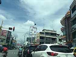 Street view of Tebing Tinggi | |
 Coat of arms | |
 Location within North Sumatra | |
 Tebing Tinggi Location in Sumatra and Indonesia  Tebing Tinggi Tebing Tinggi (Indonesia) | |
| Coordinates: 3°19′10″N 99°9′8″E / 3.31944°N 99.15222°E | |
| Country | |
| Region | Sumatra |
| Province | |
| Government | |
| • Mayor | Umar Zunaidi Hasibuan |
| • Vice Mayor | Oki Doni Siregar |
| • Chairman of City's Council of Representatives | Basyaruddin Nasution (Golkar) |
| • Vice Chairmen of City's Council of Representatives | Muhammad Azwar (Nasdem) and Iman Irdian Saragih (PDI-P) |
| Area | |
• Total | 38.44 km2 (14.84 sq mi) |
| Population (mid 2023 estimate [1]) | |
• Total | 178,914 |
| • Density | 4,700/km2 (12,000/sq mi) |
| Time zone | UTC+7 (Indonesia Western Time) |
| Area code | (+62) 621 |
| Website | www |
Tebing Tinggi Deli, officially Tebing Tinggi City, or more commonly simply Tebing Tinggi (Jawi: تبيڠ تيڠڬي) is a city near the eastern coast of North Sumatra Province of Indonesia. It has an area of 38.44 km2 and a population at the 2010 Census of 145,180,[2] which grew to 172,838 at the 2020 Census;[3] the official estimate as at mid 2023 was 178,914 (comprising 89,025 males and 89,889 females).[1] Tebing Tinggi is an enclave within Serdang Bedagai Regency, which surrounds it on all sides, and contains a kecamatan (district) bordering the city which is also named Tebing Tinggi.
Geography
[edit]According to the Agency for Information and Communication Data North Sumatra, Tebing Tinggi is one of the 8 independent cities (formerly called municipalities) in North Sumatra, located around 80 km from Medan (the capital of North Sumatra Province) and situated at a crossroads of the Trans-Sumatran Highway, connecting the East Coast Highway; Tanjungbalai, Rantau Prapat and Central Sumatra Highway; Pematangsiantar, Parapat, and Balige.
Administrative districts
[edit]The city is divided administratively into five districts (kecamatan), tabulated below with their areas and their populations at the 2010 Census[2] and the 2020 Census,[3] together with the official estimates as at mid 2023.[1] The table also includes the number of administrative villages in each district (all classed as urban kelurahan), and its post code.
| Kode Wilayah |
Name of District (kecamatan) |
Area in km2 |
Pop'n Census 2010 |
Pop'n Census 2020 |
Pop'n Estimate mid 2023 |
No. of kelurahan |
Post codes |
|---|---|---|---|---|---|---|---|
| 12.76.01 | Padang Hulu (Upstream Padang) |
8.51 | 26,714 | 32,530 | 33,858 | 7 | 20622 - 20625 |
| 12.76.05 | Tebing Tinggi Kota (Tebing Tinggi Town) |
3.47 | 24,040 | 24,192 | 23,826 | 7 | 20613, 20615, 10626 - 20628, 20632 & 20633 |
| 12.76.02 | Rambutan | 5.94 | 31,371 | 38,242 | 39,826 | 7 | 20611, 20614 and 20616 |
| 12.76.04 | Bajenis | 9.08 | 33,072 | 38,933 | 40,130 | 7 | 20611 - 20613 and 20621 |
| 12.76.03 | Padang Hilir (Downstream Padang) |
11.44 | 30,051 | 38,941 | 41,274 | 7 | 20631 - 20636 |
| Totals | 38.44 | 145,180 | 172,838 | 178,914 | 35 |
Demographics
[edit]The residents of Tebing Tinggi are Malays (70%), Batak (11%) and Chinese (8%). Javanese, Mandailing, Indian and other ethnicities are recognized ethnic minorities. The city's religion is predominantly Islam, followed by Christianity, Buddhism and other religions.
Climate
[edit]Tebing Tinggi has a tropical rainforest climate (Af) with heavy rainfall year-round.
| Climate data for Tebing Tinggi | |||||||||||||
|---|---|---|---|---|---|---|---|---|---|---|---|---|---|
| Month | Jan | Feb | Mar | Apr | May | Jun | Jul | Aug | Sep | Oct | Nov | Dec | Year |
| Mean daily maximum °C (°F) | 30.9 (87.6) |
31.5 (88.7) |
31.9 (89.4) |
32.1 (89.8) |
32.3 (90.1) |
32.3 (90.1) |
32.1 (89.8) |
31.8 (89.2) |
31.3 (88.3) |
30.9 (87.6) |
30.6 (87.1) |
30.6 (87.1) |
31.5 (88.7) |
| Daily mean °C (°F) | 26.1 (79.0) |
26.5 (79.7) |
26.8 (80.2) |
27.2 (81.0) |
27.4 (81.3) |
27.2 (81.0) |
27.0 (80.6) |
26.8 (80.2) |
26.7 (80.1) |
26.5 (79.7) |
26.3 (79.3) |
26.2 (79.2) |
26.7 (80.1) |
| Mean daily minimum °C (°F) | 21.4 (70.5) |
21.5 (70.7) |
21.8 (71.2) |
22.3 (72.1) |
22.6 (72.7) |
22.2 (72.0) |
21.9 (71.4) |
21.9 (71.4) |
22.2 (72.0) |
22.2 (72.0) |
22.0 (71.6) |
21.8 (71.2) |
22.0 (71.6) |
| Average rainfall mm (inches) | 137 (5.4) |
109 (4.3) |
113 (4.4) |
163 (6.4) |
187 (7.4) |
166 (6.5) |
159 (6.3) |
217 (8.5) |
276 (10.9) |
307 (12.1) |
249 (9.8) |
215 (8.5) |
2,298 (90.5) |
| Source: Climate-Data.org[4] | |||||||||||||
References
[edit]External links
[edit]Regencies and cities of North Sumatra | ||
|---|---|---|
Capital: Medan | ||
| Regencies |
|  |
| Cities |
| |
See also: List of regencies and cities of Indonesia | ||
This North Sumatra location article is a stub. You can help Wikipedia by expanding it. |
Original source: https://en.wikipedia.org/wiki/Tebing Tinggi
Status: article is cached
 EncycloReader
is supported by the
EncycloReader
is supported by the