Zádub-Závišín
 From Wikipedia - Reading time: 4 min
Zádub-Závišín | |
|---|---|
Municipality | |
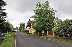 Main street | |
 Flag  Coat of arms | |
 Zádub-Závišín Location in the Czech Republic | |
| Coordinates: 49°58′16″N 12°44′36″E / 49.97111°N 12.74333°ECoordinates: 49°58′16″N 12°44′36″E / 49.97111°N 12.74333°E | |
| Country | |
| Region | Karlovy Vary |
| District | Cheb |
| First mentioned | 1273 |
| Area | |
| • Total | 6.33 km2 (2.44 sq mi) |
| Elevation | 760 m (2,490 ft) |
| Population (2022-01-01)[1] | |
| • Total | 337 |
| • Density | 53/km2 (140/sq mi) |
| Time zone | UTC+1 (CET) |
| • Summer (DST) | UTC+2 (CEST) |
| Postal code | 353 01 |
| Website | www |
Zádub-Závišín (German: Hohendorf-Abaschin) is a municipality in Cheb District in the Karlovy Vary Region of the Czech Republic. It has about 300 inhabitants.
Administrative parts[edit]
The municipality is made up of villages of Milhostov, Zádub and Závišín.
References[edit]
- ^ "Population of Municipalities – 1 January 2022". Czech Statistical Office. 2022-04-29.
Wikimedia Commons has media related to Zádub-Závišín.
| Authority control: National libraries |
|---|
This Karlovy Vary Region location article is a stub. You can help Wikipedia by expanding it. |
This article is licensed under CC BY-SA 3.0.
Original source: https://en.wikipedia.org/wiki/Zádub-Závišín
Status: article is cached
Original source: https://en.wikipedia.org/wiki/Zádub-Závišín
Status: article is cached
 EncycloReader
is supported by the
EncycloReader
is supported by the