Abbeyshrule Aerodrome
 From Wikipedia - Reading time: 6 min
Abbeyshrule Aerodrome Aeradróm Mhainistir Shruthla | |||||||||||
|---|---|---|---|---|---|---|---|---|---|---|---|
 | |||||||||||
| Summary | |||||||||||
| Airport type | Private | ||||||||||
| Operator | Longford Aviation Ltd. | ||||||||||
| Serves | Athlone, Longford, Mullingar | ||||||||||
| Location | Abbeyshrule, Ireland | ||||||||||
| Elevation AMSL | 195 ft / 59 m | ||||||||||
| Coordinates | 53°35′29″N 007°38′34″W / 53.59139°N 7.64278°W | ||||||||||
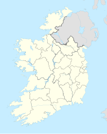
| Map | |||||||||||
 | |||||||||||
| Runways | |||||||||||
| |||||||||||
Abbeyshrule Aerodrome is a small private airfield located in south-east County Longford, Ireland, near the village of Abbeyshrule, 12 NM (22 km; 14 mi) west north-west of Mullingar[1] and beside the River Inny and the Royal Canal.
Located near the centre of Ireland, the aerodrome is situated in uncontrolled airspace and is clear of restricted areas.[2] The airfield is primarily used for leisure flights and is situated between urban centres such as Athlone, Longford and Mullingar.
The air facility was built on land rented out from local families such as the Mills family (Robert “Bertie” Mills and Mcgeoy family (Edward “Teddy” Mcgeoy). Reference was made to Edward as a building was named “The Teddy Dome”.[citation needed] The original grass airstrip at Abbeyshrule operated from 1955 to 1959, before being revived by Jimmy Byrne in the early 1970s. In 1977 a new runway was laid at the present site.[3][4][5] The bituminous runway is 620 by 18 m (2,034 by 59 ft).
Two Registered Training Facilities (RTF), Aeroclub 2000 and Skyline Flying Club,[6] are located at the aerodrome, as are several general aviation aircraft, including a Malmö MFI-9 Junior.
References
[edit]- ^ a b "Aerodrome Information - VFR Aerodromes and Heliports" (PDF). Archived from the original (PDF) on 15 June 2011.
- ^ Airfield and Airport Information Archived 2009-08-30 at the Wayback Machine. Flying in Ireland magazine.
- ^ "Abbeyshrule's Abbey & Airfield". Ask about Ireland. Retrieved 9 January 2016.
- ^ Freyne, Patrick. "Welcome to Abbeyshrule: a tidy little town". The Irish Times. Retrieved 9 January 2016.
- ^ Cusack, Adrian. "Reflecting on 30 years in the air". Longford Leader. Retrieved 9 January 2016.[permanent dead link]
- ^ "Home". Skyline Flying Club.
 KSF
KSF
