Asa (Kazakhstan)
 From Wikipedia - Reading time: 5 min
| Asa | |
|---|---|
 | |
 | |
| Location | |
| Country | Kazakhstan |
| Physical characteristics | |
| Source | Karatau Mountains |
| Mouth | Muyunkum Desert |
• coordinates | 43°55′13″N 70°12′24″E / 43.9202°N 70.2066°E |
| Length | 253 km (157 mi) |
| Basin size | 9,210 km2 (3,560 sq mi) |
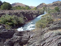
The Asa (Kazakh: Аса, Asa) is a river of Kazakhstan.
Course
[edit]The river has its source in the Karatau Mountains. It flows through lakes Bilikol and Akkol.[1] Further downstream it vanishes in the Muyunkum Desert before reaching the river Talas. The river is 253 kilometres (157 mi) long and has a basin area of 9,210 square kilometres (3,560 sq mi).[2]
References
[edit]- ^ "K-42 Topographic Chart (in Russian)". Retrieved 20 October 2022.
- ^ Асса, Great Soviet Encyclopedia
Licensed under CC BY-SA 3.0 | Source: https://en.wikipedia.org/wiki/Asa_(Kazakhstan)23 views | Status: cached on February 08 2025 09:23:13↧ Download as ZWI file
 KSF
KSF