Ashtian
 From Wikipedia - Reading time: 7 min

Ashtian
Persian: آشتيان | |
|---|---|
City | |
 | |
| Coordinates: 34°31′20″N 50°00′25″E / 34.52222°N 50.00694°E[1] | |
| Country | Iran |
| Province | Markazi |
| County | Ashtian |
| District | Central |
| Population (2016)[2] | |
• Total | 8,763 |
| Time zone | UTC+3:30 (IRST) |
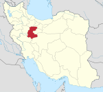
Ashtian (Persian: آشتيان)[a] is a city in the Central District of Ashtian County, Markazi province, Iran, serving as capital of both the county and the district.[4]
Demographics
[edit]Language and religion
[edit]The people of Ashtian speak a peculiar Persian dialect known as Ashtiani. They follow the Shia branch of Islam.[citation needed]
Population
[edit]At the time of the 2006 National Census, the city's population was 8,324 in 2,597 households.[5] The following census in 2011 counted 9,015 people in 2,704 households.[6] The 2016 census measured the population of the city as 8,763 people in 2,788 households.[2]
Overview
[edit]Ashtian lies in a fertile agricultural district, watered by surface streams and qanats. The region, which traditionally belonged to Tafresh County is a famous one for carpet-weaving. Among its historical monuments is the remains of a fortress and a Safavid era caravanserai.
In the past, a large number of Iranian courtiers and calligraphers were from the Tafresh and Ashtian regions. Several learned men and religious figures have stemmed from Ashtian. The Mostowfi family of Ashtian occupied several roles within the Qajar and Pahlavi administrative system. Abbās Eqbāl Āshtiyāni (عباس اقبال آشتیانی), a celebrated Iranian literary figure, and Abdolkarim Gharib, founder of geological research in Iran, were born in Ashtian. Father of Dr Mohammad Gharib, founder of modern Paediatrics in Iran, was also a native of Ashtian.
Ashtian Earth Dam
[edit]
Ashtian Earth Dam (some locals say: Band-e-Naghi Beyk) at the elevation of 2224m above sea level is one of the trourism attraction areas near the Ashtian City after Kordijan and Hazarabad villages. The water amount of the storage reduced in recent years. In March it is still cold and water temperature is about 13 °C. Some interesting birds, fox and other species of wildlife, insects, plants, etc. are in this area.
See also
[edit]Notes
[edit]References
[edit]- ^ OpenStreetMap contributors (30 August 2023). "Ashtian, Ashtian County" (Map). OpenStreetMap (in Persian). Retrieved 30 August 2023.
- ^ a b "Census of the Islamic Republic of Iran, 1395 (2016)". AMAR (in Persian). The Statistical Center of Iran. p. 00. Archived from the original (Excel) on 17 October 2020. Retrieved 19 December 2022.
- ^ Ashtian can be found at GEOnet Names Server, at this link, by opening the Advanced Search box, entering "-3053934" in the "Unique Feature Id" form, and clicking on "Search Database".
- ^ Habibi, Hassan (21 June 1369). "Approval of the organization and chain of citizenship of the elements and units of Markazi province's divisions to the citizenship of Arak city". Lamtakam (in Persian). Ministry of Interior, Political Commission of Defense of the Government Board. Archived from the original on 18 January 2024. Retrieved 18 January 2024.
- ^ "Census of the Islamic Republic of Iran, 1385 (2006)". AMAR (in Persian). The Statistical Center of Iran. p. 00. Archived from the original (Excel) on 20 September 2011. Retrieved 25 September 2022.
- ^ "Census of the Islamic Republic of Iran, 1390 (2011)". Syracuse University (in Persian). The Statistical Center of Iran. p. 00. Archived from the original (Excel) on 19 January 2023. Retrieved 19 December 2022.
External links
[edit]- "Ashtian" in Encyclopedia Iranica by C.E. Bosworth
- "Ashtiyani, the dialect of Ashtiyan" in Encyclopedia Iranica by E. Yarshater
 KSF
KSF
