Asuka-Fujiwara
 From Wikipedia - Reading time: 7 min
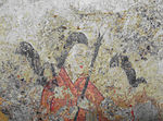
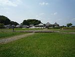
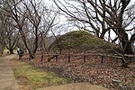
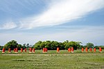
Asuka-Fujiwara: Archaeological sites of Japan’s Ancient Capitals and Related Properties is a cluster of archaeological sites from in and around the late sixth- to early eighth-century capitals of Asuka and Fujiwara-kyō, Nara Prefecture, Japan. In 2007, twenty eight sites were submitted jointly for future inscription on the UNESCO World Heritage List under the ii, iii, iv, v, and vi criteria. Currently, the submission is listed on the Tentative List.[1][2]
Since 2011, the Cultural Landscape of the Asuka Hinterland has been protected as one of the Cultural Landscapes of Japan.[3] An area of 60 ha is also protected within the Asuka Historical National Government Park.[4] Related artefacts are housed at the Asuka Historical Museum.[5]
Sites
[edit]See also
[edit]- Asuka period
- List of National Treasures of Japan (archaeological materials)
- World Heritage Sites in Japan
References
[edit]- ^ "Asuka-Fujiwara: Archaeological sites of Japan's Ancient Capitals and Related Properties". UNESCO. Retrieved 14 May 2011.
- ^ "Monuments". Asuka Mura. Retrieved 2 Feb 2013.
- ^ "奥飛鳥の文化的景観" [Cultural Landscape of the Asuka Hinterland]. Agency for Cultural Affairs. Retrieved 12 June 2012.
- ^ "Asuka Historical National Government Park". Asuka Historical National Government Park. Archived from the original on 6 November 2012. Retrieved 12 June 2012.
- ^ "Asuka Historical Museum". Nara National Research Institute for Cultural Properties. Archived from the original on 11 December 2012. Retrieved 12 June 2012.
- ^ 石舞台古墳 [Ishibutai Kofun] (in Japanese). Agency for Cultural Affairs. Retrieved 12 June 2012.
- ^ "Ishibutai Kofun". Asuka Historical Museum. Archived from the original on 24 April 2011. Retrieved 14 May 2011.
- ^ 高松塚古墳 [Takamatsuzuka Kofun] (in Japanese). Agency for Cultural Affairs. Retrieved 12 June 2012.
- ^ 高松塚古墳壁画 [Wall Paintings from the Takamatsuzuka Kofun] (in Japanese). Agency for Cultural Affairs. Retrieved 12 June 2012.
- ^ 高松塚古墳出土品 [Excavated Artefacts from the Takamatsuzuka Kofun] (in Japanese). Agency for Cultural Affairs. Retrieved 12 June 2012.
- ^ a b ""Conservation" of mural paintings of Takamatsuzuka and Kitora Tumuli Japan" (PDF). French Ministry of Culture. Archived from the original (PDF) on 5 November 2012. Retrieved 14 May 2011.
- ^ キトラ古墳 [Kitora Kofun] (in Japanese). Agency for Cultural Affairs. Retrieved 12 June 2012.
- ^ 川原寺跡 [Kawaradera Site] (in Japanese). Agency for Cultural Affairs. Retrieved 12 June 2012.
- ^ a b c McCallum, Donald F (2009). The Four Great Temples: Buddhist Archaeology, Architecture, and Icons of Seventh-Century Japan. University of Hawaii Press. ISBN 978-0-8248-3114-1.
- ^ "大官大寺跡" [Daikandaiji Site]. Agency for Cultural Affairs. Retrieved 12 June 2012.
- ^ 牽牛子塚古墳 [Asagaotsuka Kofun] (in Japanese). Agency for Cultural Affairs. Retrieved 12 June 2012.
- ^ 大和国高市郡牽牛子塚古墳出土品 [Excavated Artefacts from the Asagaotsuka Kofun] (in Japanese). Agency for Cultural Affairs. Retrieved 12 June 2012.
- ^ 中尾山古墳 [Nakaoyama Kofun] (in Japanese). Agency for Cultural Affairs. Retrieved 12 June 2012.
- ^ 酒船石遺跡 [Sakafune Ishi Site] (in Japanese). Agency for Cultural Affairs. Retrieved 12 June 2012.
- ^ 定林寺跡 [Jōrinji Site] (in Japanese). Agency for Cultural Affairs. Retrieved 12 June 2012.
- ^ "飛鳥寺跡" [Asukadera Site]. Agency for Cultural Affairs. Retrieved 12 June 2012.
- ^ 橘寺境内 [Tachibanadera Precinct] (in Japanese). Agency for Cultural Affairs. Retrieved 12 June 2012.
- ^ 岩屋山古墳 [Iwayama Kofun] (in Japanese). Agency for Cultural Affairs. Retrieved 12 June 2012.
- ^ 伝飛鳥板蓋宮跡 [Site known as the Asuka Itabuki Palace] (in Japanese). Agency for Cultural Affairs. Retrieved 12 June 2012.
- ^ "飛鳥水落遺跡" [Asuka Mizuochi Site]. Agency for Cultural Affairs. Retrieved 12 June 2012.
- ^ "飛鳥稲淵宮殿跡" [Asuka Inabuchi Palace Site]. Agency for Cultural Affairs. Retrieved 12 June 2012.
- ^ マルコ山古墳 [Marukoyama Kofun] (in Japanese). Agency for Cultural Affairs. Retrieved 12 June 2012.
- ^ 飛鳥池工房遺跡 [Asuka Pond Workshop Site] (in Japanese). Agency for Cultural Affairs. Retrieved 12 June 2012.
- ^ "Site of Asuka-ike workshop". Kashihara City. Archived from the original on 21 July 2011. Retrieved 14 May 2011.
- ^ 檜隈寺跡 [Hinokumadera Site] (in Japanese). Agency for Cultural Affairs. Retrieved 12 June 2012.
- ^ "Site of Hinokuma-dera". Kashihara City. Retrieved 14 May 2011.
- ^ Aston, W.G. (1972) [1896]. Nihongi: Chronicles of Japan from the Earliest Times to A.D. 697. Vol. 2. Tuttle. p. 379. ISBN 0-8048-0984-4.
- ^ "飛鳥京跡苑池" [Asuka Palace Ponds]. Agency for Cultural Affairs. Retrieved 12 June 2012.
- ^ 史跡 名勝 飛鳥京跡苑池 [Historic Site & Place of Scenic Beauty: Asuka Palace Pond] (in Japanese). Kashihara City. Retrieved 12 June 2012.
- ^ 岡寺跡 [Okadera Site] (in Japanese). Agency for Cultural Affairs. Retrieved 12 June 2012.
- ^ "Oka-dera". Asuka Historical Museum. Retrieved 14 May 2011.
- ^ 山田寺跡 [Yamadadera Site] (in Japanese). Agency for Cultural Affairs. Retrieved 12 June 2012.
- ^ 奈良県山田寺跡出土品 [Excavated Artefacts from Yamadadera] (in Japanese). Agency for Cultural Affairs. Retrieved 12 June 2012.
- ^ Parent, Mary Neighbour (1984). "Yamadadera: Tragedy and Triumph". Monumenta Nipponica. 39 (3). Sophia University: 307–331. doi:10.2307/2384596. JSTOR 2384596.
- ^ 藤原宮跡 [Fujiwara Palace Site] (in Japanese). Agency for Cultural Affairs. Retrieved 12 June 2012.
- ^ 本薬師寺跡 [Moto Yakushiji Site] (in Japanese). Agency for Cultural Affairs. Retrieved 12 June 2012.
- ^ "Moto Yakushiji". Asuka Historical Museum. Retrieved 14 May 2011.
- ^ 植山古墳 [Ueyama Kofun] (in Japanese). Agency for Cultural Affairs. Retrieved 12 June 2012.
- ^ "Burial site unearthed in Nara". The Japan Times. 18 August 2000. Archived from the original on 9 October 2006. Retrieved 15 May 2011.
- ^ 丸山古墳 [Maruyama Kofun] (in Japanese). Agency for Cultural Affairs. Retrieved 12 June 2012.
- ^ "Maruyama Kofun". Asuka Historical Museum. Retrieved 14 May 2011.
- ^ 菖蒲池古墳 [Shōbuike Kofun] (in Japanese). Agency for Cultural Affairs. Retrieved 12 June 2012.
- ^ "Shobu-ike Kofun". Asuka Historical Museum. Retrieved 14 May 2011.
- ^ 藤原京跡 朱雀大路跡 [Fujiwara-kyō Suzaku Avenue Site] (in Japanese). Agency for Cultural Affairs. Retrieved 12 June 2012.
- ^ 大和三山 [Yamato Sanzan] (in Japanese). Agency for Cultural Affairs. Retrieved 12 June 2012.
External links
[edit]- UNESCO Tentative List entry
- (in Japanese) Asuka-Fujiwara World Heritage
Licensed under CC BY-SA 3.0 | Source: https://en.wikipedia.org/wiki/Asuka-Fujiwara2 views | ↧ Download as ZWI file
 KSF
KSF


