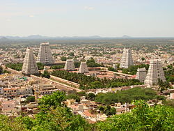
Athiyandal, Tiruvannamalai
 From Wikipedia - Reading time: 8 min
This article has multiple issues. Please help improve it or discuss these issues on the talk page. (Learn how and when to remove these messages)
|
Athiyandal
Athiyandal | |
|---|---|
Athiyandal panchayat | |
 | |
| Nickname: thenine | |
| Coordinates: 12°14′N 79°03′E / 12.24°N 79.05°E | |
| India | |
| State | Tamil Nadu |
| District | Tiruvannamalai |
| Government | |
| • Chairman | A. M. R. RAMAKIRUSHNAN (dmk) |
| Area | |
• Total | 16.3 km2 (6.3 sq mi) |
| Elevation | 171 m (561 ft) |
| Population (2012) | |
• Total | 5,901 |
| • Rank | 1 |
| • Density | 360/km2 (940/sq mi) |
| Languages | |
| • Official | Tamil |
| Time zone | UTC+5:30 (IST) |
| 606 603 | 606 603 |
| 9952149842 | 606 603 |
| Vehicle registration | TN 25 |
| Lok Sabha constituency | thiruvannamlai |
| Vidhan Sabha constituency | thiruvannamalai city |
| Climate | moderate (Köppen) |
| Avg. summer temperature | 41 °C (106 °F) |
| Avg. winter temperature | 18 °C (64 °F) |
Athiyandal is a village in Tiruvannamalai taluk, Tiruvannamalai district, Tamil Nadu State. Athiyandal is 0.6 kilometres (0.37 mi) from its district main city, Tiruvannamalai. It is 157 kilometres (98 mi) from its stat main city, Chennai. The nearest towns are Thandrampet (15.2 km), Thurinjapuram (18.1 km), Kalasapakkam (23.1 km), Keelpennathur (24.4 km).[1]
Speciality
[edit]Athiyandal "Rangammal Trust" is a world-famous Britisher's trust. It provides schools, free hospitals, medical college and polytechnic colleges. "Athiyandal Rangammal Hospital" is well known after CMC to north zone people.
Demographics
[edit]Athiyandal having population of around 6,000 people providing suburban to Tiruvannamalai urbanity. One of the major medical institutions in Ramana Maharshi rangammal hospital, comes under Tiruvannamalai urban agglomerations on Bengaluru road (via Chengam) NH-66. It is well known for its local railway station for Athiyandal as "Athiyandal Rangammal Campus and Hospital" shortly as "ARCH" at Girivalam railway route (local railway route to develop tourism).
References
[edit]- ^ "Athiyandal Population - Viluppuram, Tamil Nadu". census2011.co.in. 2011 Indian National Census. 2025. Retrieved 18 January 2025.
 KSF
KSF