Bradford Woods, Pennsylvania
 From Wikipedia - Reading time: 9 min
Bradford Woods, Pennsylvania | |
|---|---|
 Intersection at the center of the community | |
| Etymology: Thomas Bradford | |
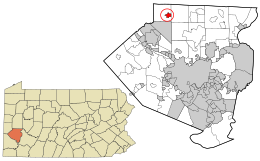
 Location in Allegheny County and the U.S. state of Pennsylvania. | |
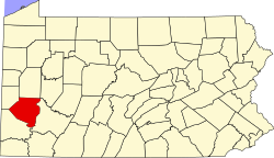
 Location of Pennsylvania in the United States | |
| Coordinates: 40°39′09″N 80°04′55″W / 40.65250°N 80.08194°W | |
| Country | United States |
| State | Pennsylvania |
| County | Allegheny |
| Incorporated | May 3, 1915 |
| Government | |
| • Mayor | Douglas Marsico (R) |
| Area | |
• Total | 0.89 sq mi (2.31 km2) |
| • Land | 0.89 sq mi (2.31 km2) |
| • Water | 0.00 sq mi (0.00 km2) |
| Elevation | 1,250 ft (380 m) |
| Population | |
• Total | 1,183 |
| • Density | 1,327.72/sq mi (512.43/km2) |
| Time zone | UTC-5 (EST) |
| • Summer (DST) | UTC-4 (EDT) |
| ZIP code | 15015 |
| Area code | 724 |
| FIPS code | 42-08064 |
| School District | North Allegheny |
| Website | www |
Bradford Woods is a borough in Allegheny County, Pennsylvania, United States. The population was 1,183 at the 2020 census.[3] A suburb of the Pittsburgh metropolitan area, it is part of the North Allegheny School District and participates in the multi-municipality Northland Public Library. It is home to Bradford Woods Elementary School.
History
[edit]Bradford Woods, originally settled as a summer getaway, was incorporated as a borough on May 3, 1915, from Marshall Township.[4] The Pittsburgh, Harmony, Butler and New Castle (Harmony Line) interurban railway previously ran through Bradford Woods, where Forest Road is today. It provided a direct route to Pittsburgh. A home rule government was established in 1974.[5]
Geography
[edit]Bradford Woods is located at 40°38′9″N 80°4′55″W / 40.63583°N 80.08194°W.[6]
According to the United States Census Bureau, the borough has a total area of 0.9 square miles (2.3 km2), all of it land. Its average elevation is 1,250 ft (381 m) above sea level.[7]
Surrounding neighborhoods
[edit]Bradford Woods has only two borders: Marshall Township to the north, south and west, and Pine Township to the east. The community is surrounded by unincorporated Wexford and has its own zip code.
Demographics
[edit]| Census | Pop. | Note | %± |
|---|---|---|---|
| 1920 | 213 | — | |
| 1930 | 370 | 73.7% | |
| 1940 | 374 | 1.1% | |
| 1950 | 458 | 22.5% | |
| 1960 | 866 | 89.1% | |
| 1970 | 970 | 12.0% | |
| 1980 | 1,264 | 30.3% | |
| 1990 | 1,329 | 5.1% | |
| 2000 | 1,149 | −13.5% | |
| 2010 | 1,171 | 1.9% | |
| 2020 | 1,183 | 1.0% | |
| Sources:[8][9][10][11][12][2] | |||
As of the census[11] of 2000, there were 1,149 people, 464 households, and 373 families residing in the borough. The population density was 1,283.2 people per square mile (495.4 people/km2). There were 478 housing units at an average density of 533.8 per square mile (206.1/km2). The racial makeup of the borough was 98.61% White, 0.09% Native American, 0.87% Asian, 0.26% from other races, and 0.17% from two or more races. Hispanic or Latino of any race were 0.78% of the population.
There were 464 households, out of which 26.3% had children under the age of 18 living with them, 75.6% were married couples living together, 4.1% had a female householder with no husband present, and 19.4% were non-families. 17.5% of all households were made up of individuals, and 5.6% had someone living alone who was 65 years of age or older. The average household size was 2.48 and the average family size was 2.80.
In the borough the population was spread out, with 18.7% under the age of 18, 5.3% from 18 to 24, 21.1% from 25 to 44, 39.3% from 45 to 64, and 15.6% who were 65 years of age or older. The median age was 47 years. For every 100 females there were 97.8 males. For every 100 females age 18 and over, there were 95.4 males.
The median income for a household in the borough was $92,820, and the median income for a family was $100,329. Males had a median income of $70,313 versus $43,125 for females. The per capita income for the borough was $51,462. About 1.1% of families and 1.4% of the population were below the poverty line, including none of those under age 18 and 5.1% of those age 65 or over.
Government and politics
[edit]The local government of Bradford Woods occupies offices in Fithian Hall (the fire hall). The current mayor is Doug Marsico.[13]
Bradford Woods Borough is protected by Bradford Woods VFC Station 115. The chief is Ben Titus and the President is Robert Farrell.
| Year | Republican | Democratic | Third Parties |
|---|---|---|---|
| 2020 | 47% 410 | 50% 437 | 1% 9 |
| 2016 | 53% 425 | 42% 331 | 5% 40 |
| 2012 | 64% 503 | 36% 282 | 0% 5 |
Notable people
[edit]- Christina Aguilera, Grammy award-winning singer, actress, and pop culture icon, grew up in Bradford Woods. In a 2002 episode of MTV Diary she returned to the area, and the owners of her former home on Bradford Road allowed her to tour her old house.
- Chris Hoke, former Pro Bowl lineman for the Pittsburgh Steelers
- Robert J. Kirkpatrick, aviator and award-winning airplane builder, who earned an Outstanding Workmanship award for his construction of Wittman Tailwind s/n 1101 at the 1965 EAA Convention in Rockford, Illinois. This aircraft is still actively flying today.
References
[edit]- ^ "ArcGIS REST Services Directory". United States Census Bureau. Retrieved October 12, 2022.
- ^ a b "Census Population API". United States Census Bureau. Retrieved October 12, 2022.
- ^ "Explore Census Data".
- ^ "Allegheny County - 2nd Class" (PDF). Retrieved October 8, 2007.
- ^ "Bradford Woods PA". Retrieved October 8, 2007.
- ^ "US Gazetteer files: 2010, 2000, and 1990". United States Census Bureau. February 12, 2011. Retrieved April 23, 2011.
- ^ "US Board on Geographic Names". United States Geological Survey. October 25, 2007. Retrieved January 31, 2008.
- ^ "Number and Distribution of Inhabitants:Pennsylvania-Tennessee" (PDF). Fifteenth Census. U.S. Census Bureau.
- ^ "Number of Inhabitants: Pennsylvania" (PDF). 18th Census of the United States. U.S. Census Bureau. Retrieved November 22, 2013.
- ^ "Pennsylvania: Population and Housing Unit Counts" (PDF). U.S. Census Bureau. Retrieved November 22, 2013.
- ^ a b "U.S. Census website". United States Census Bureau. Retrieved January 31, 2008.
- ^ "Annual Estimates of the Resident Population". U.S. Census Bureau. Archived from the original on October 19, 2013. Retrieved November 22, 2013.
- ^ Conway, Rachael (December 7, 2008). "New mayor in Bradford Woods short on experience but long on enthusiasm for job". Pittsburgh Post-Gazette.
- ^ EL. "2012 Allegheny County election". Pittsburgh Tribune-Review. Retrieved October 15, 2017.
- ^ EL. "2016 Pennsylvania general election..." Pittsburgh Post-Gazette. Retrieved October 15, 2017.
- ^ "Election Night Reporting".
 KSF
KSF