Departments of Nicaragua
 From Wikipedia - Reading time: 7 min
 |
|---|
|
|
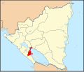
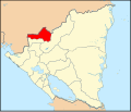
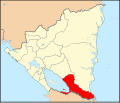
Nicaragua is a unitary republic, divided for administrative purposes into fifteen departments (Spanish: departamentos) and two autonomous regions (Spanish: regiones autónomas).

Departments
[edit]| ISO | Map | Department or autonomous region | Capital | Population (2023)[1] | Area (km2) | Pop. density (km−2) |
|---|---|---|---|---|---|---|
| NI-BO | 
|
Boaco | Boaco | 188,809 | 4,176.68 | 45.21 |
| NI-CA | 
|
Carazo | Jinotepe | 200,894 | 1,081.40 | 185.77 |
| NI-CI | 
|
Chinandega | Chinandega | 445,784 | 4,822.42 | 92.44 |
| NI-CO | 
|
Chontales | Juigalpa | 193,827 | 6,481.27 | 29.91 |
| NI-ES | 
|
Estelí | Estelí | 233,077 | 2,229.69 | 104.53 |
| NI-GR | 
|
Granada | Granada | 219,244 | 1,039.68 | 210.88 |
| NI-JI | 
|
Jinotega | Jinotega | 499,289 | 9,222.40 | 54.14 |
| NI-LE | 
|
León | León | 426,850 | 5,138.03 | 83.08 |
| NI-MD | 
|
Madriz | Somoto | 181,328 | 1,708.23 | 106.15 |
| NI-MN | 
|
Managua | Managua | 1,585,801 | 3,465.10 | 457.65 |
| NI-MS | 
|
Masaya | Masaya | 409,265 | 610.78 | 670.07 |
| NI-MT | 
|
Matagalpa | Matagalpa | 613,262 | 6,803.86 | 90.13 |
| NI-NS | 
|
Nueva Segovia | Ocotal | 282,800 | 3,491.28 | 81.00 |
| NI-RI | 
|
Rivas | Rivas | 185,514 | 2,161.82 | 85.81 |
| NI-SJ | 
|
Río San Juan | San Carlos | 140,786 | 7,540.90 | 18.67 |
Autonomous regions
[edit]In 1987, the new constitution established the Charter of Autonomy (limited self-government) for the former department of Zelaya, comprising the entire eastern half of the country. The department was divided into two autonomous regions (communities): the North Caribbean Coast Autonomous Region and the South Caribbean Coast Autonomous Region. The Charter of Autonomy is largely based on the model used by Spain. The communities are governed by a Governor and a Regional Council.[2]
| ISO | Map | Department or autonomous region | Capital | Population (2023)[3] | Area (km2) | Pop. density (km−2) |
|---|---|---|---|---|---|---|
| NI-AN | 
|
North Caribbean Coast Autonomous Region | Bilwi | 563,088 | 33,105.98 | 17.01 |
| NI-AS | 
|
South Caribbean Coast Autonomous Region | Bluefields | 434,270 | 27,260.02 | 15.93 |
See also
[edit]Notes
[edit]- ^ "Anuario Estadistico 2022" (PDF) (in Spanish). Instituto Nacional de Información de Desarrollo. February 2024. Archived (PDF) from the original on 4 September 2023. Retrieved 29 August 2024.
- ^ Clarisa Indiana Ibarra Rivera. "El modelo de justicia en las regiones autónomas de la costa Caribe nicaragüense: ¿utopia o realidad?" (PDF). corteidh.or.cr. Retrieved 29 November 2022.
- ^ "Anuario Estadistico 2022" (PDF) (in Spanish). Instituto Nacional de Información de Desarrollo. February 2024. Archived (PDF) from the original on 4 September 2023. Retrieved 29 August 2024.
- Instituto Nicaragüense de Estudios Territoriales (INETER). División Política Administrativa del País. March, 2000.
- Instituto Nicaragüense de Fomento Municipal (INIFOM). Municipios – General.
- International Organization for Standardization (ISO). Codes for the representation of names of countries and their subdivisions. ISO 3166-2:NI.
Licensed under CC BY-SA 3.0 | Source: https://en.wikipedia.org/wiki/Departments_of_Nicaragua81 views | Status: cached on August 16 2025 12:55:39↧ Download as ZWI file
 KSF
KSF