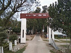
Dumuria Upazila
 From Wikipedia - Reading time: 7 min
Dumuria
ডুমুরিয়া | |
|---|---|
 Dumuria Upazila Parishad | |
 | |
| Coordinates: 22°48.5′N 89°25.5′E / 22.8083°N 89.4250°E | |
| Country | |
| Division | Khulna |
| District | Khulna |
| Area | |
• Total | 454.23 km2 (175.38 sq mi) |
| Population | |
• Total | 343,899 |
| • Density | 760/km2 (2,000/sq mi) |
| Time zone | UTC+6 (BST) |
| Postal code | 9250[2] |
| Website | Official Map of Dumuria |
Dumuria (Bengali: ডুমুরিয়া) is an upazila of Khulna District[3] in the Division of Khulna, Bangladesh.
Etymology
[edit]Dumuria is named for the presence of Dumur, the Bengali word for Wild Fig.
History
[edit]Ancient Monuments and Antiquities Chenchuri Nilkuthi, Chuknagar Nilkuthi, Madhugram Dak Bungalow.
Historical facts In 1948, the Tevaga movement took place in Sobna, Dhanibunia, Kanaidanga, Orabunia and Bakultala villages of the upazila. During the Liberation War, many Bengalis including Prafulla Kumar Biswas, Indubhushan, Lalchand, Amulya, Mahendra, Raicharan, Nihar and Ratan were martyred in the attack of Pak Army in Kalitalapara in April 1971. In addition, 14 soldiers of the allied forces were killed in the face-off between the liberation forces and the allied forces in Shalua Bazar. Chuknagar village was used as a transit point by the Bengali refugees going to India who were suffering from the atrocities of the Pakistan Army in the early days of the Liberation War. On May 20, 1971, a large number of refugees gathered in Chuknagar were indiscriminately killed by Pak forces. Every year this day is observed as 'Chuknagar Massacre Day'.[3]
Geography
[edit]Dumuria is located at 22°48′30″N 89°25′30″E / 22.8083°N 89.4250°E. It has 71,909 households and a total area of 454.23 square kilometres (175.38 sq mi). There are two major rivers, Shipsha and Shangrail.
Demographics
[edit]As of the 2011 Census of Bangladesh, Dumuria upazila had 71,909 households and a population of 305,675. 58,123 (19.01%) were under 10 years of age. Dumuria had an average literacy rate of 52.58%, compared to the national average of 51.8%, and a sex ratio of 996 females per 1000 males. 19,828 (6.49%) of the population lived in urban areas.[5][6]
According to the 1991 Bangladesh census, Dumuria had a population of 256,503. Males constituted 51.12% of the population, and females 48.88%. The population aged 18 or over was around 138,764. Dumuria had an average literacy rate of 36.1% (7+ years), compared to the national average of 32.4% .[7]
Administration
[edit]Dumuria Upazila is divided into 14 union parishads: Atlia, Dhamalia, Dumuria, Ghutudia, Khornia, Magurkhali, Maguraghona, Raghunathpur, Rangpur, Rudaghora, Sahos, Shorafpur, Shovna, and Vandarpara. The union parishads are subdivided into 189 mauzas and 240 villages.[8] [9]
Notable residents
[edit]- Gazi family of Chuknagar, Dumuria
- Gazi Shamsur Rahman (1921–1998), lawyer, writer, translator, columnist and television personality
- Gazi Ainun Nishat (born 1948), water resource and climate change specialist
- Haldar Mohammad Abdul Gaffar (1936–2020), lieutenant general
- Khan Tipu Sultan (1950–2017), politician
- Narayan Chandra Chanda, MP (Khulna-5), Minister of Ministry of Fisheries And Livestock of Bangladesh[10][11]
See also
[edit]References
[edit]- ^ National Report (PDF). Population and Housing Census 2022. Vol. 1. Dhaka: Bangladesh Bureau of Statistics. November 2023. p. 400. ISBN 978-9844752016.
- ^ "Bangladesh Postal Code". Dhaka: Bangladesh Postal Department under the Department of Posts and Telecommunications of the Ministry of Posts, Telecommunications and Information Technology of the People's Republic of Bangladesh. 21 October 2024.
- ^ a b Sandipak Mallik (2012), "Dumuria Upazila", in Sirajul Islam; Ahmed A. Jamal (eds.), Banglapedia: National Encyclopedia of Bangladesh (Second ed.), Asiatic Society of Bangladesh
- ^ Population and Housing Census 2022 - District Report: Khulna (PDF). District Series. Dhaka: Bangladesh Bureau of Statistics. June 2024. ISBN 978-984-475-271-9.
- ^ "Bangladesh Population and Housing Census 2011 Zila Report – Khulna" (PDF). bbs.gov.bd. Bangladesh Bureau of Statistics.
- ^ "Community Tables: Khulna district" (PDF). bbs.gov.bd. Bangladesh Bureau of Statistics. 2011.
- ^ "Population Census Wing, BBS". Archived from the original on 2005-03-27. Retrieved November 10, 2006.
- ^ "District Statistics 2011: Khulna" (PDF). Bangladesh Bureau of Statistics. Archived from the original (PDF) on 13 November 2014. Retrieved 14 July 2014.
- ^ Dumuria upazila, retrieved 12 January 2021
- ^ Ministry of Fisheries And Livestock, Republic Bangladesh, retrieved 13 November 2016
- ^ List of 10th Parliament Members, archived from the original on 28 September 2018, retrieved 13 November 2016
 KSF
KSF