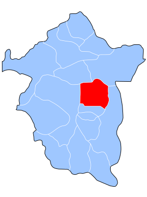
Enugu East
 From Wikipedia - Reading time: 7 min
Enugu East | |
|---|---|
 Enugu East (red) in Enugu State (blue) | |
| Coordinates: 6°32′N 7°32′E / 6.533°N 7.533°E | |
| Country | |
| State | Enugu State |
| Government | |
| • Local Government Chairman | Hon.Engr. Pastor Beloved Dan Anike (PDP). Deputy Chairman = Hon. Engr. Kingsley Obinna Anike (PDP) |
| Area | |
• Total | 383 km2 (148 sq mi) |
| Population (2006 census) | |
• Total | 279,089 |
| Time zone | UTC+1 (WAT) |
| 3-digit postal code prefix | 400 |
| ISO 3166 code | NG.EN.EE |
 | |
Enugu East is a Local Government Area of Enugu State, Nigeria. Enugu East is made up of three zones/districts: Nike-Uno, Ugwogo and Mbuli NjodoIts.[1] Headquarters are in the town of Nkwo Nike.
It had an area of 383 km2 and a population of 279,089 at the 2006 census.
The postal code of the area is 400.[2]
Government
[edit]Enugu East Local Government Area is one of the lower tier administrations within Enugu state and it is under the Enugu west senatorial zone. This local government operates within the Enugu state government to provide development to the communities surrounding them.
Political Divisions
[edit]Enugu East is one of the seventeen local government areas of Enugu State, and it is one of the three local governments that made up the Enugu Town urban area; alongside Enugu North and Enugu South Local Governments. It comprises 3 district zones; Nike-Uno, Ugwogo and Mbuli NjodoIts in which other towns and villages reside under their authority.
| s/n | Nike-Uno | Ugwogo | Mbuli Njodolts |
|---|---|---|---|
| 1. | Agbogazi | Adaeze | |
| 2. | Ako | Amankpa | |
| 3. | Akpoga | Farm Settlements | |
| 4. | Alulu | Obinagu | |
| 5. | Amoji | Ogbodogo | |
| 6. | Amokpo | Okpuhu | |
| 7. | Azama | Ugwunkwo | |
| 8. | Edem | Umunagbo | |
| 9. | Effomwe | Umunnameze | |
| 10. | Emene | Umunonu | |
| 11. | Ibeagwa | Utazi | |
| 12. | Ije-Amaowelle | - | |
| 13. | Nbulunjodo | - | |
| 14. | Nchetanche | - | |
| 15. | Neke Odenigbo | - | |
| 16. | Nekeuno | - | |
| 17. | Ngwuomo | - | |
| 18. | Nkwubo | - | |
| 19. | Nokpa | - | |
| 20. | Obinagu | - | |
| 21. | Onuogba | - | |
| 22. | Onuohu | - |
References
[edit]- ^ "LG Election: Enugu East protest candidate imposition". Vanguard News. 2022-01-11. Retrieved 2022-02-28.
- ^ "Post Offices- with map of LGA". NIPOST. Archived from the original on 2009-10-07. Retrieved 2009-10-20.
- ^ "List of Towns and Villages in Enugu East LGA". Nigeria Zip Codes. 2014-03-10. Retrieved 2022-02-28.
 KSF
KSF
