Categories
Forks of Waters, Virginia
 From Wikipedia - Reading time: 6 min
Forks of Waters, Virginia | |
|---|---|
 Aerial view of Forks of Waters. The South Branch Potomac River flows diagonally across the image. | |
 Forks of Waters  Forks of Waters | |
| Coordinates: 38°28′56″N 79°30′31″W / 38.48222°N 79.50861°W | |
| Country | United States |
| State | Virginia |
| County | Highland |
| Elevation | 2,313 ft (705 m) |
| Time zone | UTC−5 (Eastern (EST)) |
| • Summer (DST) | UTC−4 (EDT) |
| ZIP codes | 24465 |
| GNIS feature ID | 1483492[1] |
_near_Forks_of_Waters_in_Highland_County,_Virginia.jpg)
Forks of Waters (formerly Strait Creek) is an unincorporated community located in Highland County, Virginia, United States.[1] Forks of Waters is located approximately 6 miles (9.7 km) northeast of Monterey at the junction of U.S. Route 220 and Virginia State Route 642.[2][3] Forks of Waters is so named due to the convergence of the Strait Creek with the South Branch Potomac River near the community.[2][4] After passing through Forks of Waters, the South Branch Potomac River enters West Virginia approximately 1 mile (1.6 km) to the northeast.[4]
References
[edit]- ^ a b "Forks of Waters". Geographic Names Information System. United States Geological Survey, United States Department of the Interior. Retrieved December 23, 2013.
- ^ a b "Domestic Geographic Name Report Form - Forks of Waters, Virginia". U.S. Department of the Interior Board on Geographic Names. Retrieved December 23, 2013.
- ^ "Forks of Waters, Virginia" (Map). Google Maps. Retrieved December 23, 2013.
- ^ a b Morton, Oren Frederic (1911). A History of Highland County, Virginia. Published by the author. p. 13.
Municipalities and communities of Highland County, Virginia, United States | ||
|---|---|---|
| Town | 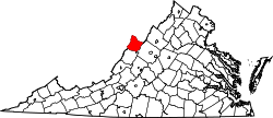 | |
| CDP | ||
| Other communities | ||
| Footnotes | ‡This populated place also has portions in an adjacent county or counties | |
This Highland County, Virginia state location article is a stub. You can help Wikipedia by expanding it. |
Licensed under CC BY-SA 3.0 | Source: https://en.wikipedia.org/wiki/Forks_of_Waters,_Virginia37 views | Status: cached on August 12 2025 15:53:10↧ Download as ZWI file
 EncycloReader
is supported by the
EncycloReader
is supported by the