Goliad State Park and Historic Site
 From Wikipedia - Reading time: 10 min
| Goliad State Park and Historic Site | |
|---|---|
 Former custodian's house for Goliad State Park. Built by the Civilian Conservation Corps circa 1936 | |
| Location | US 183 at San Antonio River, Goliad, Texas |
| Coordinates | 28°39′24″N 97°23′14″W / 28.65667°N 97.38722°W |
| Area | 188.3 acres (76.2 ha) |
| Established | 1936 |
| Visitors | 48,677 (in 2022)[1] |
| Governing body | Texas Parks and Wildlife Department |
Goliad State Park Historic District | |
| Area | 250 acres (100 ha) |
| Built | 1931 |
| Architect | Atlee Bernard Ayres, Samuel Phelps Vosper, et al. |
| Architectural style | Colonial Revival, Moderne, NPS Rustic |
| NRHP reference No. | 01000258[2] |
| Significant dates | |
| Added to NRHP | March 12, 2001 |
| Designated TSHS | 1936 |
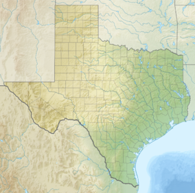
Goliad State Park and Historic Site is a 188.3 acres (76 ha) state park located along the San Antonio River on the southern edge of Goliad, Texas.[3] It was listed on the National Register of Historic Places (#01000258) on March 12, 2001.[4]
Park
[edit]The park features campsites, screened shelters, Group Hall and Chapel, an amphitheater, and the El Camino Real de los Tejas Visitors Center.
Historic sites
[edit]Goliad area historic sites include:[5]
- Reconstructed Mission Nuestra Señora del Espíritu Santo de Zúñiga;
- Ruins of Mission Nuestra Señora del Rosario;
- Reconstructed birthplace of Ignacio Zaragoza; and
- Fannin Memorial Monument, the burial site of James Fannin and the Goliad Massacre victims, by Raoul Josset, 1939.
- Presidio La Bahía.

See also
[edit]- List of Texas state parks
- List of Texas State Historic Sites
- National Register of Historic Places listings in Goliad County, Texas
- Recorded Texas Historic Landmarks in Goliad County
References
[edit]- ^ Christopher Adams. "What is the most visited state park in Texas? Here's the top 10 countdown". KXAN.com. Retrieved November 21, 2023.
- ^ "National Register Information System". National Register of Historic Places. National Park Service. July 9, 2010.
- ^ Turner, David. "GOLIAD STATE HISTORICAL PARK". TSHA.
- ^ "National Register of Historic Places". National Park Service.
- ^ "Goliad Area Historic Sites". Texas Parks and Wildlife.
External links
[edit]Wikimedia Commons has media related to Goliad State Park and Historic Site.
- Goliad State Park & Historic Site
- The Look of Nature: Designing Texas State Parks During the Great Depression—Goliad
- Home movie from the Baylor family of Goliad State Park on Texas Archive of the Moving Image
Licensed under CC BY-SA 3.0 | Source: https://en.wikipedia.org/wiki/Goliad_State_Park_and_Historic_Site6 views | Status: cached on November 27 2024 08:51:58↧ Download as ZWI file
 KSF
KSF


