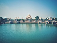
Govardhan Hill
 From Wikipedia - Reading time: 7 min

Govardhana Hill (Sanskrit: गोवर्धन; pronounced [ɡoːʋɐrdʰɐnɐ]), also called Mount Govardhana and Giriraj, is a sacred Hindu site in the Mathura district of Uttar Pradesh, India on an 8 km long hill located in the area of Govardhan and Radha Kund,[1][2] which is about 21 kilometres (13 miles) from Vrindavan.[3] It is the sacred centre of Braj and is identified as a natural form of Krishna, the Govardhana Shila.[4][5]
Geography
[edit]Govardhan Hill, stretching from Radha Kund to south of Govardhan, is a long ridge that, at its highest, stands 100 feet (30 m) above the surrounding land. At the southern end of the hill is the village of Punchari, while at the crest stand the villages of Aanyor and Jatipura.[6] The parikarma path of Govardhan hill is intersected by some part of district Deeg of State of Rajasthan.
Background
[edit]Govardhan Hill is considered a sacred site because it is the setting for many legends relating to the life of Lord Krishna, the deity believed to be embodied in the earth of the hill. Krishna and his brother Balarama are said to have spent many happy hours roaming among its shade providing groves, pools, caves and lush cow-pastures. An Eden-like sanctuary, the area's waterfalls, garden-grove (van), arbour (nikunj), water tank (kund), and flora are depicted in scenes of Krishna's adventures with Radha.[6]
Temples
[edit]The buildings and other structures on the Hill date from the sixteenth century. As of 2013[update], there is no known archaeological evidence of any remains of greater age.[7]
A few of the sites include:
- The sandstone monument and lake of Kusum Sarovar.[1][2]
- Giriraj Temple[8]
- Shri Chaitanya Temple, built of red sandstone and adorned with paintings of Krishna and Radha[9]
- Radha Kund Temple[9]
- Mansi Ganga Lake[9]
- Danghati Temple[9]
-
Kusum Sarovar ("Lake of Flowers"), one of the holy sites on Govardhan Hill
-
Kusum Sarovar, Govardhan after extensive restoration, 2017
-
Govardhan Giriraj Temple, Mathura dedicated to Krishna
-
Mansi Ganga
-
Temple dedicated to Govardhan
Legends
[edit]
There are legends of Krishna’s saving the hill from a flood, dalliances with gopis (cow-herders)’, and interactions with demons and gods. Artwork has been created of the hill represented as a bull and a peacock, Krishna in a cave, the hill as a mountain of food, depicted in the floods brought on by Indra, and with the Yamuna River.[6]
Recent development
[edit]In 2018, the Uttar Pradesh Chief Minister declared Govardhan as a pilgrimage centre along with Mathura, Baldev, Nandgaon, Radha Kund, and Gokul.[10] The U.P. Government has also planned to rejuvenate Govardhan Parvat with Dvapara Yuga flora such as kadamb, karoli, tamal, pakkad, and tilkan.[11]
See also
[edit]References
[edit]- ^ a b Dev Prasad (27 January 2015). Krishna: A Journey through the Lands & Legends of Krishna. Jaico Publishing House. pp. PT 147. ISBN 978-81-8495-170-7.
- ^ a b Henry George Keene (1878). A Handbook for Visitors to Agra and Its Neighbourhood. Thacker, Spink. pp. 71–72.
- ^ "Vrindavan to Radha Kund". Google mpas. Retrieved 7 April 2017.
- ^ David L. Haberman, River of Love in an Age of Pollution: The Yamuna River of Northern India, Page 264 ISBN 0-520-24789-2
- ^ Kapila D. Silva; Neel Kamal Chapagain (2013). Asian Heritage Management: Contexts, Concerns, and Prospects. Routledge. p. 178. ISBN 978-0-415-52054-6.
- ^ a b c Kapila D. Silva; Neel Kamal Chapagain (2013). Asian Heritage Management: Contexts, Concerns, and Prospects. Routledge. pp. 178–179. ISBN 978-0-415-52054-6.
- ^ Kapila D. Silva; Neel Kamal Chapagain (2013). Asian Heritage Management: Contexts, Concerns, and Prospects. Routledge. p. 180. ISBN 978-0-415-52054-6.
- ^ Ritika Handoo (2 December 2016). "Here Lord Krishna lifted Govardhan hill—This can be your travel guide to reach Giriraj Temple!". ZeeNews. Retrieved 7 April 2017.
- ^ a b c d Amit Sengupta (16 June 2015). "Spiritual Sojourn (sic) in Govardhan". Retrieved 7 April 2017.
- ^ "Five more places declared as 'teerth sthals' in Mathura | Agra News". The Times of India.
- ^ Dua, Rohan (4 January 2018). "With ancient flora, UP plans to revive Govardhan Parvat". The Times of India. Retrieved 13 April 2020.
Further reading
[edit]- Rajasekhara Dasa (2001). Govardhana Hill: India's Most Sacred Mountain. Vedanta Vision Publications. ISBN 978-1-310-32111-5.
External links
[edit]- Srila Prabhupada explains Govardhana Puja Archived 5 May 2018 at the Wayback Machine
- http://www.icompositions.com/music/song.php?sid=199187Ballad of Govardhana Archived 29 December 2014 at the Wayback Machine
- Ballad of Govardhana Hill Archived 29 December 2014 at the Wayback Machine
- The Story of Govardhan
- krishna story lifting govardhan parvat
- Pictures of Govardhan Hill Archived 17 November 2015 at the Wayback Machine
- Exclusive video of Parikrama of Govardhan Hill
IN-UP 27°30′37.93″N 77°28′33.98″E / 27.5105361°N 77.4761056°E
 KSF
KSF


