Harmony, Marinette County, Wisconsin
 From Wikipedia - Reading time: 7 min
Harmony, Wisconsin | |
|---|---|
| Coordinates: 45°05′57″N 87°49′11″W / 45.09917°N 87.81972°W | |
| Country | |
| State | |
| County | Marinette |
| Elevation | 213 m (699 ft) |
| Time zone | UTC-6 (Central (CST)) |
| • Summer (DST) | UTC-5 (CDT) |
| Area code(s) | 715 & 534 |
| GNIS feature ID | 1566072[2] |
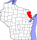
Harmony (formerly Harmony Corners)[1][3] is an unincorporated community located in the town of Grover, Marinette County, Wisconsin, United States. Harmony is located 5 miles (8.0 km) northwest of Peshtigo.[4]
Geography
[edit]
Harmony is located at the intersection of County Highways D and DD[5] at an elevation of 699 feet (213 m).[1] It is connected by road to Peshtigo to the southeast and Marinette to the east (via Highway 64).[5] The intersection of County Highway D and Highway 64 approximately 1.6 miles (2.6 km) west-northwest of Harmony was formerly known as Gould's Corners[6][7] after a farm located there owned by Addison Norris Gould (1850–1925).
History
[edit]A post office was established in Harmony in 1885 and James H. Potter (1827–1905) was appointed postmaster.[8][9] A cheese factory formerly operated in Harmony.[10]
References
[edit]- ^ a b c "Harmony, Wisconsin". Geographic Names Information System. United States Geological Survey, United States Department of the Interior.
- ^ U.S. Geological Survey Geographic Names Information System: Harmony, Marinette County, Wisconsin
- ^ Standard Atlas of Marinette County Wisconsin Including a Plat Book of the Villages, Cities and Townships of the County. Chicago: Geo. A. Ogle & Co. 1912. p. 68.
- ^ Marinette County (PDF) (Map). Wisconsin Department of Transportation. Archived from the original (PDF) on June 14, 2011. Retrieved August 9, 2011.
- ^ a b Porterfield Quadrangle Wisconsin, 15 Minute Series (Topographic). 1963. Map, 1:62,500. Washington, DC: U. S. Geological Survey.
- ^ "Planning Monument to Andrew Eklund". Green Bay Press Gazette. April 19, 1939. p. 16. Retrieved March 7, 2020 – via Newspapers.com.

- ^ Proceedings of the Board of Supervisors of Marinette County. Marinette, WI: Board of Supervisors. 1909. p. 65.
- ^ "Postal Bulletin. Changes". The Inter Ocean. January 12, 1885. p. 5. Retrieved August 15, 2014 – via Newspapers.com.

- ^ "Postoffices Established". Griggs County Courier. January 23, 1885. p. 6. Retrieved December 13, 2019 – via Newspapers.com.

- ^ "Harmony Corners' Cheese Factory Changes Hands". Green Bay Press-Gazette. November 13, 1925. p. 25. Retrieved December 14, 2019 – via Newspapers.com.

 KSF
KSF

