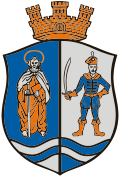
Harta, Hungary
 From Wikipedia - Reading time: 7 min
Harta
Hartau | |
|---|---|
Large village | |
| Coordinates: 46°41′35″N 19°01′52″E / 46.693°N 19.031°E | |
| Country | |
| County | Bács-Kiskun |
| District | Kalocsa |
| Area | |
• Total | 129.68 km2 (50.07 sq mi) |
| Population (2001) | |
• Total | 3,758 |
| • Density | 29/km2 (80/sq mi) |
| Time zone | UTC+1 (CET) |
| • Summer (DST) | UTC+2 (CEST) |
| Postal code | 6326 |
| Area code | (+36) 78 |
Harta (German: Hartau; Croatian: Hartava or Karta) is a village in Bács-Kiskun county, Hungary.
Demography
[edit]References
[edit]- ^ "Hrvatski glasnik" (PDF) (in Croatian). Archived from the original (PDF) on 2011-07-21. (910 KB) Racke Pinkuše, 2. lipnja 2005.
External links
[edit]Wikimedia Commons has media related to Harta (Hungary).
- Official website in Hungarian
- (in Hungarian) Harta a Vendégvárón
- (in Hungarian) HartaPortal - hírek Hartáról
46°42′N 19°02′E / 46.700°N 19.033°E
Licensed under CC BY-SA 3.0 | Source: https://en.wikipedia.org/wiki/Harta,_Hungary44 views | Status: cached on August 10 2025 20:42:18↧ Download as ZWI file
 KSF
KSF


