Historic Albemarle Tour
 From Wikipedia - Reading time: 9 min
Historic Albemarle Tour | |
|---|---|
| Route information | |
| Maintained by NCDOT | |
| Existed | 1975–present |
| Location | |
| Country | United States |
| State | North Carolina |
| Counties | Bertie, Beaufort, Camden, Chowan, Currituck, Dare, Edgecombe, Gates, Halifax, Hertford, Hyde, Martin, Northampton, Pasquotank, Perquimans, Tyrrell, Washington |
| Highway system | |
The Historic Albemarle Tour or Historic Albemarle Highway is a tour route located in northeastern North Carolina. The tour follows several U.S. and State highways in the seventeen county region, identifying historic sites and towns, marked with brown signs with the George Monck, 1st Duke of Albemarle coat of arms.
Route description
[edit]


The tour route is not a linear route, like most scenic routes, but a collection of several highways in the region. The following list are the component highways that make-up the tour route:
| Highway | Route | Sites of Interest |
|---|---|---|
| Williamston–VA state line | ||
| Washington–VA state line | ||
| Williamston–Whalebone Junction | ||
| Barco–Whalebone Junction | ||
| NC 561–VA state line | ||
| Washington–Whalebone Junction | ||
| Halifax–VA state line | ||
| Pitt-Martin county line–Murfreesboro | ||
| NC 99–VA state line | ||
| Barco–Sligo | ||
| US 64–US 17 | ||
| US 264–NC 99/NC 306 | ||
| Pantego–NC 32 | ||
| Sligo–VA state line | ||
| US 13–US 258/NC 561 | ||
| US 301–US 258 |
Sites
[edit]- Aurora Fossil Museum
- Bath, the oldest continuously inhabited town in North Carolina
- Belhaven Memorial Museum, currently housed in Belhaven City Hall, in the town of Belhaven
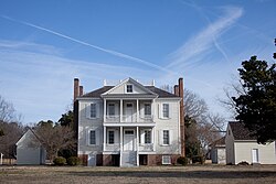
- Camden County Welcome Center, located on the Dismal Swamp Canal
- Chicamacomico Life-Saving Station located in Rodanthe
- Columbia
- Corolla, location of the Currituck Beach Light
- Edenton, former colonial capital of the Province of North Carolina
- Elizabeth City
- Frisco Native American Museum in Frisco, North Carolina
- Graveyard of the Atlantic Museum in Hatteras Village
- Halifax, location of the Fourth Provincial Congress, which authorized the Halifax Resolves
- Hertford
- Hope Plantation, a restored antebellum plantation house near Windsor
- Jackson
- Museum of the Albemarle
- North Carolina Aquariums with locations in Manteo, Fort Fisher, and Pine Knoll Shores
- Ocracoke
- Plymouth
- Roanoke Island Festival Park in Manteo
- Somerset Place, a restored antebellum plantation house near Creswell
- Tarboro
- Williamston
- Windsor
History
[edit]The tour route was established in 1975 by the North Carolina General Assembly, which included designated highways, locations and signage. A 1977 act amended the original law to expand the list of designated highways and locations.[1][2]
References
[edit]- ^ "NC Senate Bill 315: An act to designate certain major highways s Historic Albemarle Tours Highways" (PDF). Retrieved March 20, 2016.
- ^ "NC Senate Bill 409: An act to amend the Historic Albemarle Tour Highway Act" (PDF). Retrieved March 20, 2016.
External links
[edit]Licensed under CC BY-SA 3.0 | Source: https://en.wikipedia.org/wiki/Historic_Albemarle_Tour13 views | Status: cached on April 11 2025 11:05:47↧ Download as ZWI file
 KSF
KSF