Huston Park Wilderness
 From Wikipedia - Reading time: 6 min
| Huston Park Wilderness | |
|---|---|
| Location | Carbon County, Wyoming, USA |
| Nearest city | Laramie, WY |
| Coordinates | 41°06′N 106°56′W / 41.100°N 106.933°W |
| Area | 30,588 acres (123.79 km2) |
| Established | 1984 |
| Governing body | U.S. Forest Service |
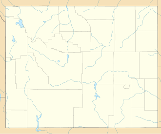
The Huston Park Wilderness is located in south central Wyoming in the United States. Entirely within Medicine Bow National Forest, the wilderness was designated in 1984 to preserve the northernmost section of the central Rocky Mountains, an area of high mountain peaks and coniferous forest.
U.S. Wilderness Areas do not allow motorized or mechanized vehicles, including bicycles. Although camping and fishing are allowed with proper permit, no roads or buildings are constructed and there is also no logging or mining, in compliance with the 1964 Wilderness Act. Wilderness areas within National Forests and Bureau of Land Management areas also allow hunting in season.
See also
[edit]References
[edit]- ^ Protected Area Profile for Huston Park Wilderness from the World Database on Protected Areas. Retrieved May 2, 2023.
External links
[edit]- "Huston Park Wilderness". The National Wilderness Preservation System. Wilderness.net. Retrieved August 16, 2006.
- "USGS Solomon Creek (WY,CO) Topo Map Quad" (map). TopoQuest. Retrieved June 30, 2008.
- "Wilderness Legislation: The Wilderness Act of 1964". The National Wilderness Preservation System. Wilderness.net. Archived from the original on February 28, 2012. Retrieved August 16, 2006.
Licensed under CC BY-SA 3.0 | Source: https://en.wikipedia.org/wiki/Huston_Park_Wilderness11 views | Status: cached on May 13 2025 08:48:31↧ Download as ZWI file
 KSF
KSF
