Categories
Ingalls, Oklahoma
 From Wikipedia - Reading time: 6 min
Ingalls, Oklahoma | |
|---|---|
 | |
| Coordinates: 36°6′6″N 96°52′53″W / 36.10167°N 96.88139°W | |
| Country | United States |
| State | Oklahoma |
| County | Payne |
| Government | |
| Area | |
| • Total | 2.59 sq mi (6.72 km2) |
| • Land | 2.59 sq mi (6.72 km2) |
| • Water | 0.00 sq mi (0.00 km2) |
| Elevation | 919 ft (280 m) |
| Population (2020) | |
| • Total | 192 |
| • Density | 74.05/sq mi (28.59/km2) |
| Time zone | UTC-6 (Central (CST)) |
| • Summer (DST) | UTC-5 (CDT) |
| ZIP codes | 74074 |
| Area code | 405 |
| FIPS code | 40-37000 |
| GNIS feature ID | 2805329[2] |


Ingalls is a census-designated place (CDP) in eastern Payne County, Oklahoma, about 9 miles (14 km) east of Stillwater. The town was settled as a result of the "Unassigned Lands" land run in 1889, and had a post office from January 22, 1890, until October 31, 1907.[3] It was named for Senator John J. Ingalls of Kansas.[4] During the 1890s the population peaked at about 150, then began to decline.[5]
History[edit]

Ingalls was a peaceful community that rarely ever had any commotion, until it became notable as the site of the Battle of Ingalls on September 1, 1893, which was a shootout between U.S. Marshals and the Doolin-Dalton gang.[6]
A new post office, named Signet, Oklahoma, was established on a site slightly northwest of the old Ingalls townsite on June 21, 1921, and became part of a new community. The residents of the Ingalls part protested and the name was then officially changed back after its closure.[3]
Only a few deserted, old buildings are still present, including replicas of the Ingalls Hotel, its actual name the Pierce O.K. Hotel, a livery stable, saloon, and general store.[7]
Demographics[edit]
| Census | Pop. | Note | %± |
|---|---|---|---|
| 2020 | 192 | — | |
| U.S. Decennial Census[8] | |||
References[edit]
- ^ "ArcGIS REST Services Directory". United States Census Bureau. Retrieved September 20, 2022.
- ^ a b U.S. Geological Survey Geographic Names Information System: Ingalls, Oklahoma
- ^ a b McRill, Leslie. "Old Ingalls: The Story of a Town that Will Not Die." Archived 2006-09-05 at the Wayback Machine, Chronicles of Oklahoma Vol. 36. Retrieved September 16, 2014.
- ^ Gannett, Henry (1905). The Origin of Certain Place Names in the United States. Govt. Print. Off. p. 165.
- ^ ""Oklahoma's Past: Payne County" Oklahoma Archaeological Survey. University of Oklahoma. 23 Oct 2007.
- ^ Samuelson, Nancy B. "Dalton Gang," Encyclopedia of Oklahoma History and Culture, Oklahoma Historical Society. Accessed February 19, 2016
- ^ "The Ingalls Townsite." Oklahoma Archaeology Survey." Retrieved September 12, 2014.
- ^ "Census of Population and Housing". Census.gov. Retrieved June 4, 2016.
Sources[edit]
- McRill, Leslie. "Old Ingalls: The Story of a Town That Will Not Die", Chronicles of Oklahoma 36:4 (October 1958) 429-445 (retrieved August 17, 2006)
- "Oklahoma's Past: Payne County" Oklahoma Archaeological Survey. University of Oklahoma. 23 Oct 2007.
- Shirley, Glenn (July 1990). Gunfight at Ingalls: Death of an Outlaw Town. Barbed Wire Pr. p. 180. ISBN 978-0935269062.
External links[edit]
Municipalities and communities of Payne County, Oklahoma, United States | ||
|---|---|---|
| Cities | 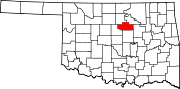 | |
| Towns | ||
| CDPs | ||
| Other communities | ||
| Ghost town | ||
| Footnotes | ‡This populated place also has portions in an adjacent county or counties | |
| International | |
|---|---|
| National | |
 EncycloReader
is supported by the
EncycloReader
is supported by the