Inhambane Airport
 From Wikipedia - Reading time: 6 min
This article needs additional citations for verification. (March 2020) |
Inhambane Airport | |||||||||||||||
|---|---|---|---|---|---|---|---|---|---|---|---|---|---|---|---|
 | |||||||||||||||
| Summary | |||||||||||||||
| Airport type | Public | ||||||||||||||
| Operator | Aeroportos de Mocambique (Mozambique Airports Company) | ||||||||||||||
| Serves | Inhambane | ||||||||||||||
| Location | Inhambane, Mozambique | ||||||||||||||
| Elevation AMSL | 30 ft / 9 m | ||||||||||||||
| Coordinates | 23°52′35.15″S 35°24′30.76″E / 23.8764306°S 35.4085444°E | ||||||||||||||
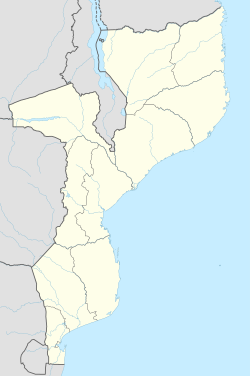
| Map | |||||||||||||||
 | |||||||||||||||
| Runways | |||||||||||||||
| |||||||||||||||
Source: WAD[1] | |||||||||||||||
Inhambane Airport is an airport in Jangamo District, Inhambane Province, Mozambique (IATA: INH, ICAO: FQIN).
Airlines and destinations
[edit]| Airlines | Destinations |
|---|---|
| LAM Mozambique Airlines | Maputo, Vilanculos |
See also
[edit]References
[edit]- ^ "INHAMBANE". World Aero Data. WorldAeroData.com. Archived from the original on 13 November 2006. Retrieved 2 March 2020.
External links
[edit]
Licensed under CC BY-SA 3.0 | Source: https://en.wikipedia.org/wiki/Inhambane_Airport20 views | Status: cached on August 06 2025 01:02:53↧ Download as ZWI file
 KSF
KSF