Inot
 From Wikipedia - Reading time: 5 min
| Inot | |
|---|---|
| Location | |
| Country | Romania |
| Counties | Bihor County |
| Villages | Păgaia, Viișoara, Marghita |
| Physical characteristics | |
| Mouth | Barcău |
• location | Marghita |
• coordinates | 47°20′21″N 22°19′58″E / 47.3393°N 22.3329°E |
| Length | 22 km (14 mi) |
| Basin size | 124 km2 (48 sq mi) |
| Basin features | |
| Progression | Barcău→ Crișul Repede→ Körös→ Tisza→ Danube→ Black Sea |
| Tributaries | |
| • left | Boian |
| • right | Pățălușa |
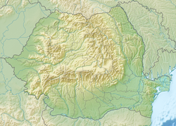
The Inot is a right tributary of the river Barcău in Romania.[1][2] It discharges into the Barcău in Marghita.[3] Its length is 22 km (14 mi) and its basin size is 124 km2 (48 sq mi).[2]
References
[edit]- ^ "Planul național de management. Sinteza planurilor de management la nivel de bazine/spații hidrografice, anexa 7.1" (PDF, 5.1 MB). Administrația Națională Apele Române. 2010. pp. 203–204.
- ^ a b Atlasul cadastrului apelor din România. Partea 1 (in Romanian). Bucharest: Ministerul Mediului. 1992. p. 121. OCLC 895459847. River code: III.1.44.33.13
- ^ Inot (jud. Bihor), e-calauza.ro
Licensed under CC BY-SA 3.0 | Source: https://en.wikipedia.org/wiki/Inot105 views | Status: cached on June 18 2025 17:04:52↧ Download as ZWI file
 KSF
KSF