Kahnuj County
 From Wikipedia - Reading time: 8 min
Kahnuj County
Persian: شهرستان کهنوج | |
|---|---|
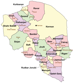
 Location of Kahnuj County in Kerman province (bottom left, pink) | |
 Location of Kerman province in Iran | |
| Coordinates: 27°54′N 57°40′E / 27.900°N 57.667°E[1] | |
| Country | |
| Province | Kerman |
| Capital | Kahnuj |
| Districts | Central, Chah Morid |
| Population (2016)[2] | |
• Total | 95,848 |
| Time zone | UTC+3:30 (IRST) |
Kahnuj County (Persian: شهرستان کهنوج) is in Kerman province, Iran. Its capital is the city of Kahnuj.[3]
History
[edit]After the 2006 National Census, Faryab District was separated from the county in the establishment of Faryab County.[4] Dehkahan Rural District was separated from Manujan County to join the Central District.[5] Kutak Rural District was created in the district, and Howmeh Rural District was separated from it in the formation of Chah Morid District, including the new Chah Rigan Rural District.[4]
After the 2016 census, the villages of Chah Morid[6] and Dehkahan[7] were elevated to city status.
Demographics
[edit]Population
[edit]At the time of the 2006 census, the county's population was 102,269 in 21,780 households.[8] The following census in 2011 counted 86,290 people in 21,166 households.[9] The 2016 census measured the population of the county as 95,848 in 26,276 households.[2]
Administrative divisions
[edit]Kahnuj County's population history and administrative structure over three consecutive censuses are shown in the following table.
| Administrative Divisions | 2006[8] | 2011[9] | 2016[2] |
|---|---|---|---|
| Central District | 70,664 | 75,064 | 84,603 |
| Dehkahan RD[a] | 7,980 | 7,397 | |
| Howmeh RD | 10,491 | ||
| Kutak RD | 8,768 | 8,320 | |
| Nakhlestan RD | 21,602 | 14,339 | 16,262 |
| Dehkahan (city)[b] | |||
| Kahnuj (city) | 38,571 | 43,977 | 52,624 |
| Chah Morid District | 11,226 | 11,245 | |
| Chah Rigan RD | 5,791 | 6,013 | |
| Howmeh RD | 5,435 | 5,232 | |
| Chah Morid (city)[c] | |||
| Faryab District[d] | 31,605 | ||
| Golashkerd RD | 5,353 | ||
| Hur RD | 14,920 | ||
| Mehruiyeh RD | 6,824 | ||
| Faryab (city) | 4,508 | ||
| Total | 102,269 | 86,290 | 95,848 |
| RD = Rural District | |||
See also
[edit]![]() Media related to Kahnuj County at Wikimedia Commons
Media related to Kahnuj County at Wikimedia Commons
Notes
[edit]- ^ Transferred from Manujan County[5]
- ^ Became a city after the 2016 census[7]
- ^ Became a city after the 2016 census[6]
- ^ Transferred to Faryab County[4]
References
[edit]- ^ OpenStreetMap contributors (6 December 2024). "Kahnuj County" (Map). OpenStreetMap (in Persian). Retrieved 6 December 2024.
- ^ a b c Census of the Islamic Republic of Iran, 1395 (2016): Kerman Province. amar.org.ir (Report) (in Persian). The Statistical Center of Iran. Archived from the original (Excel) on 20 October 2020. Retrieved 19 December 2022.
- ^ Habibi, Hassan (c. 2024) [Approved 21 June 1369]. Approval of the organization and chain of citizenship of the elements and units of the national divisions of Kerman province, centered in the city of Kerman. lamtakam.com (Report) (in Persian). Ministry of the Interior, Defense Political Commission of the Government Council. Proposal 3233.1.5.53; Letter 907-93808; Notification 82812/T139K. Archived from the original on 30 January 2024. Retrieved 30 January 2024 – via Lam ta Kam.
- ^ a b c Rahimi, Mohammad Reza (c. 2022) [Approved 16 November 1389]. Letter of approval regarding national divisions in Kerman province. qavanin.ir (Report) (in Persian). Ministry of the Interior, Board of Ministers. Proposal 44522/42/1/4/1. Archived from the original on 3 October 2022. Retrieved 2 February 2024 – via Laws and Regulations Portal of the Islamic Republic of Iran.
- ^ a b Rahimi, Mohammad Reza (7 July 2010). "The new city of Dowsari was added to the map of national divisions". farsnews.ir (in Persian). Ministry of the Interior, Cabinet of Ministers. Archived from the original on 16 November 2023. Retrieved 16 November 2023 – via Fars Mardia Corporation.
- ^ a b Fazli, Abdolreza Rahmani (2 January 2019) [Approved 17 May 2017]. Decisions on the conversion of villages in the center of the district into cities. rc.majlis.ir (Report) (in Persian). Ministry of the Interior, Board of Ministers. Letter 33667/59806. Archived from the original on 22 December 2019. Retrieved 6 December 2024 – via Islamic Parliament Research Center of the Islamic Republic of Iran.
- ^ a b Jahangiri, Ishaq (c. 2023) [Approved 12 December 1397]. Letter of approval regarding the conversion of Dehkahan village, Dehkahan Rural District, Central District of Kahnuj County in Kerman province, to a city. qavanin.ir (Report) (in Persian). Ministry of the Interior, Board of Ministers. Proposal 197104. Archived from the original on 29 June 2023. Retrieved 29 June 2023 – via Laws and Regulations Portal of the Islamic Republic of Iran.
- ^ a b Census of the Islamic Republic of Iran, 1385 (2006): Kerman Province. amar.org.ir (Report) (in Persian). The Statistical Center of Iran. Archived from the original (Excel) on 20 September 2011. Retrieved 25 September 2022.
- ^ a b Census of the Islamic Republic of Iran, 1390 (2011): Kerman Province. irandataportal.syr.edu (Report) (in Persian). The Statistical Center of Iran. Archived from the original (Excel) on 29 March 2023. Retrieved 19 December 2022 – via Iran Data Portal, Syracuse University.
 KSF
KSF