Korala
 From Wikipedia - Reading time: 9 min
| Korala | |
|---|---|
 View of PLA Kunmuja border outpost from Nepal | |
| Elevation | 4,660 m (15,289 ft) |
| Location | China–Nepal border |
| Range | Himalayas |
| Coordinates | 29°18′14″N 83°58′7″E / 29.30389°N 83.96861°E |
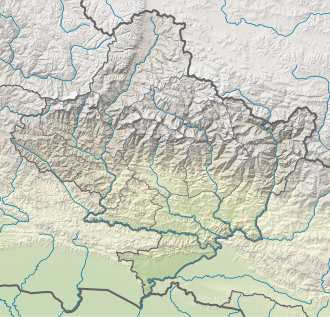
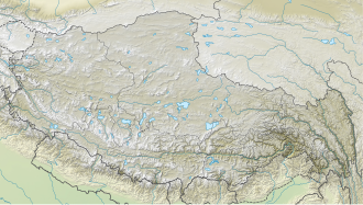
Korala or Kora La or Koro La {Nepali: (Nepali: कोरला]; literally Kora Pass} is a mountain pass between Tibet and Gandaki Province. At only 4,660 metres (15,290 ft) in elevation, it has been considered the lowest drivable path between Tibetan Plateau and the Indian subcontinent.[1] It currently serves as a vehicle border crossing between China and Nepal.[2][3] Korala in Mustang is the fourth border point that Beijing has reopened after the Rasuwa-Kerung, Tatopani-Khasa and Yari (Humla)-Purang. [4]
Geography
[edit]Korala is situated on the drainage divide between the Yarlung Tsangpo and Ganges river basins. At 4,660 m (15,290 ft), it is the lowest pass across the Himalayan mountain range. As such, it forms the key col for K2 on the ridgeline connecting it to Mount Everest.[5] The Kali Gandaki River has its source near the southern side of the pass.
History
[edit]Korala is one of the oldest routes between the two regions. It was historically used for salt trade between Tibet and Nepalese kingdoms.[6] Up until 2008 when Nepali monarchy was abolished, Upper Mustang was the Kingdom of Lo, an ethnic Tibetan kingdom that was a suzerainty of Kingdom of Nepal. The suzerainty allowed for a certain level of independence in local governance from the Nepalese central government.[7]
During the late 1950s and 60s, the Tibetan guerrilla group Chushi Gangdruk operated out of Upper Mustang with the intention of raiding PLA positions in Tibet.[7] This led to a border incident that caused the killing of a Nepalese officer who was mistaken by Chinese border guards as a Tibetan rebel.[8][9]
People's Republic of China and Kingdom of Nepal officially signed border agreement in 1961.[10] The border was set slightly north of the traditional boundary marker. The traditional location of Korala is marked by a stupa lies a bit south of the demarcated border between China and Nepal at 29°18′14″N 83°58′7″E / 29.30389°N 83.96861°E.[7]
In late December 1999, the 17th claimant Karmapa Ogyen Trinley Dorje fled Tibet through this area.[11][12][13] In response, China built a border fence immediately after.[6] There is a PLA border outpost named "Kunmuja" a few miles on Chinese side, it is the westernmost border outpost in Tibet Military District. The outpost was renovated in 2009 to have a modern facility.[14]
The border was closed in the 1960s. However, a semiannual cross-border trade fair remained, during which the border was open to local traders, until the COVID-19 pandemic.[6] In 2012, Nepal and China agreed to open 6 more official border crossings, Korala being one of them.[15] In July 2016, Nepalese government announced that this border crossing is expected to open, and also expects it to be the third most important crossing between the two countries.[16] As of 2022[update], the border infrastructure on the Chinese side has been completed, Nepali authority is in the process of upgrading the road network.[17]
The border crossing opened in 2023. Port facilities were built at Lektse on the Chinese side and Nechung on the Nepali side.[18][19] Daily consumer goods, construction materials, electronic materials and clothes are imported to Mustang, while pashmina, agricultural products and yarsagumba are exported to China.[20]
References
[edit]- ^ Peissel, Michel (October 1965). "Mustang, Nepal's Lost Kingdom". National Geographic. Retrieved 2017-02-10.
high point of 4660 m at Kora La on the Mustang-TAR border, the lowest drivable corridor through the Himalayas linking the Tibetan Plateau via Nepal to the tropical Indian plains
- ^ "Beijing to reopen fourth border point with Nepal". Kathmandu Post. 12 November 2023. Retrieved 7 February 2024.
- ^ "Korala check point opens for all Mustang folks". The Himalayan Times. 14 November 2023. Retrieved 7 February 2024.
- ^ "Beijing to reopen fourth border point with Nepal".
- ^ Helman, Adam (2005). The Finest Peaks: Prominence and Other Mountain Measures. Trafford Publishing. ISBN 9781412059954. Retrieved 14 April 2020.
- ^ a b c Murton, Galen (March 2016). "A Himalayan Border Trilogy: The Political Economies of Transport Infrastructure and Disaster Relief between China and Nepal". Cross-Currents E-Journal. ISSN 2158-9674. Archived from the original on 2020-11-24. Retrieved 2017-02-09.
- ^ a b c Cowan, Sam (17 January 2016). "The curious case of the Mustang incident". The Record. Retrieved 2017-02-10.
- ^ "Chinese Troops Kill a Nepalese; 18 Captured in Reds' Raid Across Border -- 'Urgent' Protest Sent to Peiping". New York Times. 30 June 1960. Retrieved 2017-02-10.
- ^ Elleman, Bruce; Kotkin, Stephen; Schofield, Clive (2014). "China-Nepal Border". Beijing's Power and China's Borders: Twenty Neighbors in Asia. Routledge. p. 211. ISBN 9781317515654. Retrieved 2017-02-10.
- ^ [China-Nepal Border Agreement] (in Chinese). 1961-10-05 – via Wikisource.
- ^ "The Karmapa's Great Escape (December 28, 1999 – January 5, 2000) -". Karmapa – The Official Website of the 17th Karmapa. Retrieved 2017-02-10.
we were not discovered and arrived in Mustang, Nepal, on the morning of December 30, 1999
- ^ Crossette, Barbara (31 January 2000). "Buddhist's Escape From Tibet, by Car, Horse and Plane". New York Times. Retrieved 2017-02-10.
- ^ "Press Statement from the 17-year-old Karmapa Ogyen Trinley Dorje April 27, 2001, Gyuto Ramoche Tantric University, Sidbhari, Distt. Kangra, HP, India" (Press release). Worldbridges Tibet. 27 April 2001. Archived from the original on 15 April 2008. Retrieved 16 March 2008.
- ^ "中国边海防巡礼之昆木加哨所" [Tour of Chinese Border Guards and Coast Guards - Kunmuja Border Outpost]. chinamil.com.cn (in Chinese). Archived from the original on 2017-06-01. Retrieved 2017-02-11.
西藏军区最西边的哨所——昆木加哨所
- ^ Prithvi Man Shrestha; Jaya Bahadur Rokaya (24 March 2016). "Nepal, China rush to open Hilsa border". Kathmandu Post. Retrieved 2017-02-10.
Nepal has also given priority to opening this border point along with Kimathanka and Korala in Mustang.
- ^ Tripathi, Binod (8 July 2016). "Korala border to open within a year". Kathmandu Post. Retrieved 2017-02-10.
- ^ "Govt starts preparing DPR of Korala dry port at Nepal-China border". My Republica. 2021-03-07. Retrieved 25 February 2022.
According to the ministry, most of the infrastructures that aid bilateral trade have already been completed on the Chinese side of the border. Nepali authorities have started upgrading the 186 km road network that connects Beni-Jomsom-Korala.
- ^ "New land port linking China's Xizang with Nepal opens". The State Council Information Office of China. Xinhua. 13 November 2023. Retrieved 13 February 2024.
- ^ "Nepal awaits Korala border reopening as China readies infrastructure on its side". Kathmandu Post. 31 October 2023. Retrieved 7 February 2024.
- ^ "Reopening of Korala border points makes Mustang locals happy". Rising Nepal Daily. 17 November 2023. Retrieved 7 February 2024.
 KSF
KSF


