List of neighborhoods in Woodbridge Township, New Jersey
 From Wikipedia - Reading time: 7 min
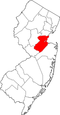
Woodbridge is a township in Middlesex County, New Jersey. According to the United States Census Bureau, the township had a total land area of including 23.213 square miles (60.122 km2). There are many distinct sections,[1][2][3] many of which are census-designated places (CDPs). Some have their own ZIP Codes.
Woodbridge Township's municipal administration officially recognizes ten geographical sections,[4][5] reflected in its slogan "Ten small towns, one great community";[6] These are Avenel, Colonia, Fords, Hopelawn, Iselin, Keasbey, Menlo Park Terrace, Port Reading, Sewaren, Woodbridge (Woodbridge Proper).
Residents from the central section describe themselves as being from "Woodbridge," while people in other areas describe themselves as being from those particular communities in place of being from Woodbridge.[7]
Sections and neighborhoods
[edit]See also
[edit]- Middlesex Greenway (New Jersey)
- List of neighborhoods in Edison, New Jersey
- Neighborhoods in Perth Amboy, New Jersey
References
[edit]- ^ a b c d e f g h i j k l m n "NJDOT Graphic Information System Maps Middlesex" (PDF). New Jersey Department of Transportation. Retrieved March 2, 2020.
- ^ a b c Virginia B. Troeger and Robert James McEwen, Woodbridge: New Jersey's Oldest Township (Arcadia Publishing, 2002; ISBN 0738523941), p. 103.
- ^ a b c Gannett, Henry (January 28, 1895). "A Geographic Dictionary of New Jersey". U.S. Government Printing Office – via Google Books.
- ^ Burns, Sean (May 17, 2017). "Woodbridge Township Street Map". Woodbridge Twp. Division of Engineering. Retrieved June 8, 2022.
- ^ "The 10 sections of Woodbridge Township, N.J." Google MyMaps. June 13, 2015.
- ^ "Home Page". Woodbridge Township.
- ^ a b Zimmer, David M.; Sheingold, Dave; Shkolnikova, Svetlana; Fagan, Matt (June 14, 2018). "Sorry, your New Jersey hometown may not be a town at all". northjersey.com. Retrieved June 29, 2023.
- ^ Locality Search, State of New Jersey. Accessed February 7, 2015.
- ^ "Boynton Beach". Geographic Names Information System. United States Geological Survey, United States Department of the Interior.
- ^ "A look at the Jersey Shore's forgotten amusement parks".
- ^ a b Gazetteer of New Jersey Places, United States Census Bureau
- ^ "Edgars". Geographic Names Information System. United States Geological Survey, United States Department of the Interior.
- ^ U.S. Geological Survey Geographic Names Information System: Fords Census Designated Place, Geographic Names Information System. Accessed July 5, 2012.
- ^ "Hazelton". Geographic Names Information System. United States Geological Survey, United States Department of the Interior.
- ^ "Keasbey". Geographic Names Information System. United States Geological Survey, United States Department of the Interior.
- ^ "Sand Hills". Geographic Names Information System. United States Geological Survey, United States Department of the Interior.
- ^ "Sand Hills, Edison, New Jersey" (Map). Google Maps. Retrieved February 14, 2015.
- ^ The Sand Hills of Bonhamtown
- ^ "Shore View". Geographic Names Information System. United States Geological Survey, United States Department of the Interior.
- ^ "Woodbridge Oaks". Geographic Names Information System. United States Geological Survey, United States Department of the Interior.
 KSF
KSF


