List of railway stations in Essex
 From Wikipedia - Reading time: 6 min

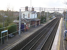
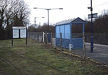


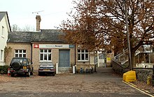

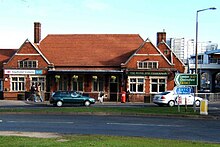

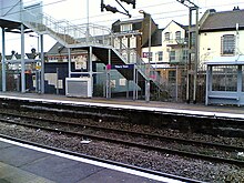
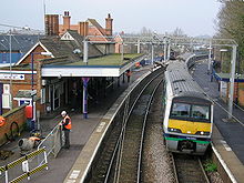
This is a list of railway stations in Essex, a county in the East of England. It includes all railway stations that are part of the National Rail network, and which currently have timetabled train services. The Central line of the London Underground and Heritage railway stations within Essex are not listed.
Rail operators
[edit]The main operator in the county is Greater Anglia, operated by Abellio and Mitsui. They operate services from Liverpool Street in London to all parts of the county, including commuter services within Essex, and longer distance services to Norwich and Peterborough. Greater Anglia also operate the Stansted Express service from London to Stansted Airport. The other major operators in Essex are c2c, a subsidiary of Trenitalia, who operate services from London's Fenchurch Street to Southend-on-Sea, and the Elizabeth line, operated by MTR Corporation for Transport for London, who operate services from Reading via central London to Shenfield. The Arriva subsidiary CrossCountry operate long-distance services from the West Midlands to Stansted Airport. CrossCountry also serve Audley End.
Stations
[edit]The following table lists the name of each station, along with (where known) the year it first opened and the local authority in whose area the station lies. The table also shows the train operators who currently serve each station, and the final two columns give information on the number of passengers using each station in recent years, as collated by the Office of Rail Regulation, a Government body. The figures are based on ticket sales, and are given to the nearest 100.[1]
See also
[edit]- List of London Underground stations
- Closed London Underground stations
- List of railway stations in Kent
Footnotes
[edit]- a

Numbered map of the districts and unitary authorities of Essex.
1: Harlow
2: Epping Forest
3: Brentwood
4: Basildon
5: Castle Point
6: Rochford
7: Maldon
8: Chelmsford
9: Uttlesford
10: Braintree
11: Colchester
12: Tendring
13: Thurrock (Unitary)
14: Southend-on-Sea (Unitary) - b Braintree moved in 1869 to accommodate through running of trains to Bishops Stortford. The site of the original station became a goods yard.[35]
- c Southend Central was rebuilt in 1889, and enlarged in 1899.[4]
References
[edit]- ^ a b c "Station usage". Office of Rail Regulation. Archived from the original on 5 July 2007. Retrieved 25 January 2008.
- ^ a b c d e f g h "History of the Sunshine Coast line". Essex and South Suffolk Community Rail Partnership. Archived from the original on 10 October 2007. Retrieved 4 February 2008.
- ^ a b c d e "History of the Crouch Valley line". Essex and South Suffolk Community Rail Partnership. Archived from the original on 19 November 2008. Retrieved 4 February 2008.
- ^ a b c d e f g h i j Bettley, James (2007). Essex. London: Yale University Press. ISBN 978-0-300-11614-4.
- ^ "Battlesbridge Conservation Area" (PDF). Chelmsford Borough Council. Retrieved 4 February 2008.
- ^ "Billericay history". Billericay.net. Archived from the original on 10 February 2008. Retrieved 4 February 2008.
- ^ "The industrial development of Braintree". Enjoy Braintree District. Archived from the original on 30 October 2007. Retrieved 5 February 2008.
- ^ "Rail users lose free car parking". Harwich and Manningtree Standard. Clacton-on-Sea: Newsquest. 12 February 2004. Retrieved 5 February 2008.
- ^ The parliamentary gazetteer of England and Wales 1845-46; Volume 2: E-K. London: A. Fullarton & Co. 1848.
- ^ "Bures". Subterranea Britannica. Retrieved 3 February 2008.
- ^ a b c d e f g h i j k l m n o "Basildon's railway stations". Basildon History. Retrieved 3 February 2008.
- ^ "Chappel & Wakes Colne". Subterranea Britannica. Retrieved 3 February 2008.
- ^ Galt, William (1844). Railway Reform: Its Expediency and Practicability Considered. London: Pelham Richardson.
- ^ Phillips, Charles (1989). The Tendring Hundred Railway; A History of The Colchester to Clacton and Walton Lines. YaConnor & Butler. ISBN 0-947699-15-5.
- ^ "The Peter Rogers Collection". Sheffield Railwayana Auctions. Archived from the original on 15 August 2006. Retrieved 13 February 2008.
- ^ "Great Chesterford Historic Town Assessment Report" (PDF). Essex County Council. Retrieved 13 February 2008.
- ^ "Harlow's history and geography". Memorial University, Canada. Archived from the original on 21 January 2008. Retrieved 6 February 2008.
- ^ Powell, W. R. (Editor) (1983). History of the County of Essex, Volume 8: Chafford and Harlow Hundreds. Victoria County History.
{{cite book}}:|author=has generic name (help) - ^ a b Kay, Peter (2006). Essex Railway Heritage. Wivenhoe: Peter Kay. ISBN 978-1-899890-40-8.
- ^ a b "History of the Mayflower line". Essex and South Suffolk Community Rail Partnership. Archived from the original on 10 October 2007. Retrieved 4 February 2008.
- ^ "Green wedge policy" (PDF). Braintree District Council. Retrieved 6 February 2008.[permanent dead link]
- ^ a b Cooper, Janet, ed. (1994). History of the County of Essex, Volume 9: Borough of Colchester. Victoria County History. ISBN 0-19-722784-8.
- ^ "Village design statement" (PDF). Ingatestone & Fryerning Parish Council. Archived from the original (PDF) on 11 August 2006. Retrieved 6 February 2008.
- ^ a b Cooper, Janet, ed. (1994). History of the County of Essex, Volume 10: Lexden Hundred. Victoria County History. ISBN 0-19-722795-3.
- ^ Moffat, Hugh (1987). East Anglia's First Railways. Lavenham: Terence Dalton. ISBN 0-86138-038-X.
- ^ "History of Newport". Uttlesford District Council. Retrieved 5 February 2008.
- ^ "A brief history of Prittlewell village and its church". St Mary's Church, Prittlewell. Archived from the original on 12 March 2008. Retrieved 6 February 2008.
- ^ Yearsley, Ian (2005). Rayleigh - A History. NPI Media Group. ISBN 978-1-86077-355-6.
- ^ "Roydon: Historic Settlement Report" (PDF). Planarch. Retrieved 6 February 2008.
- ^ Labrum, E. A. (1994). Civil Engineering Heritage. London: Thomas Telford. ISBN 0-7277-1970-X.
- ^ "Sir Norman Foster" (PDF). Pritzker Architecture Prize. Archived from the original (PDF) on 10 July 2007. Retrieved 5 February 2008.
- ^ "Stansted Mountfitchet Conservation Area" (PDF). Uttlesford District Council. Retrieved 5 February 2008.
- ^ "The nineteenth century". The village of Stock in Essex. Retrieved 6 February 2008.
- ^ "Witham: Historic town assessment report" (PDF). Essex County Council. Retrieved 5 February 2008.
- ^ Gordon, D. I. (1968). A Regional History of the Railways of Great Britain - Volume 5: Eastern Counties. Newton Abbot: David & Charles. ISBN 0-7153-4321-1.
 KSF
KSF