List of scheduled monuments in Taunton Deane
 From Wikipedia - Reading time: 17 min

Taunton Deane was a local government district with borough status in Somerset, England. It merged with West Somerset to form Somerset West and Taunton on 1 April 2019. Its council was based in Taunton. The district was formed on 1 April 1974, under the Local Government Act 1972, by a merger of the Municipal Borough of Taunton, Wellington Urban District, Taunton Rural District, and Wellington Rural District. Taunton Deane was granted borough status in 1975, enabling the mayoralty of Taunton to be continued, when other districts did not have mayors.[1] The district was given the name of an alternate form of the Taunton Deane Hundred.
A scheduled monument is a nationally important archaeological site or monument which is given legal protection by being placed on a list (or "schedule") by the Secretary of State for Digital, Culture, Media and Sport; English Heritage takes the leading role in identifying such sites. The legislation governing this is the Ancient Monuments and Archaeological Areas Act 1979. The term "monument" can apply to the whole range of archaeological sites, and they are not always visible above ground. Such sites have to have been deliberately constructed by human activity. They range from prehistoric standing stones and burial sites, through Roman remains and Medieval structures such as castles and monasteries, to later structures such as industrial sites and buildings constructed for the World Wars or the Cold War.[2]
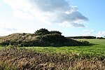
There are 33 scheduled monuments in Taunton Deane. Many of them are Neolithic through to the Bronze and Iron Ages such as bowl barrows, cairns along with hill forts such as Norton Camp.[3] Castle Neroche was an Iron Age hill fort which was reused as a Norman motte-and-bailey castle.[4] Burrow Mump shows evidence of Roman use but is better known as a Norman motte-and-bailey castle,[5] and later church.[6] It was presented, in 1946, by Major Alexander Gould Barrett, to the National Trust to serve as a memorial to the 11,281[7] Somerset men who lost their lives during the first and second world wars.[8]
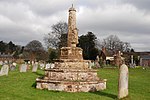
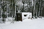
The Medieval period is represented by several churchyard crosses. The defensive walls and part of Taunton Castle, which has Anglo-Saxon origins and was expanded during the Medieval and Tudor eras, is included.[9][10] More recent sites include Poundisford Park, Buckland Priory, Bradford Bridge and a duck decoy from the 17th century. Some of the sites such as Balt Moor Wall are of uncertain date; however the most recent are air traffic control buildings, pillboxes and fighter pens from RAF Culmhead, situated at Churchstanton on the Blackdown Hills.[11][12] The monuments are listed below using the titles given in the English Heritage data sheets.
Monuments
[edit]See also
[edit]- Scheduled monuments in Somerset
- Grade I listed buildings in Taunton Deane
- Grade II* listed buildings in Taunton Deane
Notes
[edit]- ^ The date given is the date used by Historic England as significant for the initial building or that of an important part in the structure's description.
- ^ Sometimes known as OSGB36, the grid reference is based on the British national grid reference system used by the Ordnance Survey.
- ^ The "List Entry Number" is a unique number assigned to each listed building and scheduled monument by Historic England.
References
[edit]- ^ "About the Mayor". Taunton Deane Borough Council. Archived from the original on 6 June 2011. Retrieved 23 January 2010.
- ^ "Scheduled Monuments". English Heritage. Retrieved 9 September 2014.
- ^ Historic England. "Norton Camp (189007)". Research records (formerly PastScape). Retrieved 26 March 2011.
- ^ Historic England. "Castle Neroche (190295)". Research records (formerly PastScape). Retrieved 22 March 2011.
- ^ a b "Burrow Mump, Burrowbridge". Somerset Historic Environment Record. Somerset County Council. Retrieved 4 October 2010.
- ^ Historic England. "Remains of Church on Burrow Mump (1344609)". National Heritage List for England. Retrieved 2 March 2014.
- ^ Dunning, Robert (1983). A History of Somerset. p. 101. ISBN 0-85033-461-6.
- ^ a b Leete-Hodge, Lornie (1985). Curiosities of Somerset. Bodmin: Bossiney Books. p. 82. ISBN 0-906456-98-3.
- ^ Bush, Robin (1994). Somerset: The Complete Guide. Dovecote Press. pp. 202–206. ISBN 1-874336-26-1.
- ^ "Taunton's History". Taunton Town Centre!. Archived from the original on 3 June 2007. Retrieved 21 November 2007.
- ^ Berryman, David (2006). Somerset airfields in the Second World War. Newbury: Countryside Books. pp. 50–86. ISBN 1-85306-864-0.
- ^ "Culmhead airfield, Trickey Warren". Somerset Historic Environment Record. Somerset County Council. Retrieved 25 July 2009.
- ^ Historic England. "Balt Moor Wall (1018952)". National Heritage List for England. Retrieved 20 August 2014.
- ^ Historic England. "Balt Moor Wall (191938)". Research records (formerly PastScape). Retrieved 20 August 2014.
- ^ "Balt Moor Wall, between East Lyng and Athelney, Lyng". Somerset Historic Environment Record. Somerset County Council. Retrieved 20 August 2014.
- ^ Historic England. "Borough Bank (190827)". Research records (formerly PastScape). Retrieved 20 August 2014.
- ^ Historic England. "Bowl barrow at the west end of Cothelstone Hill, 825m NNE of St Agnes' Well (1015085)". National Heritage List for England. Retrieved 20 August 2014.
- ^ Historic England. "Bowl barrow 840m north east of Bagborough House (1016500)". National Heritage List for England. Retrieved 20 August 2014.
- ^ Historic England. "Bowl barrow and folly ruins on Cothelstone Hill, 1km north east of St Agnes' Well (1015086)". National Heritage List for England. Retrieved 20 August 2014.
- ^ Historic England. "Bowl barrow on Cothelstone Hill, 1.07km north east of St Agnes' Well (1015087)". National Heritage List for England. Retrieved 20 August 2014.
- ^ Historic England. "Bowl barrow on Cothelstone Hill, 885m NNE of St Agnes' Well (1015950)". National Heritage List for England. Retrieved 20 August 2014.
- ^ Historic England. "Bradford Bridge (1060375)". National Heritage List for England. Retrieved 17 August 2014.
- ^ Bush, Robin (1994). Somerset: The Complete Guide. Dovecote Press. pp. 90–91. ISBN 1-874336-26-1.
- ^ Dunning, Robert; C R Elrington; A P Baggs; M C Siraut. "Durston". Victoria County History. British History Online. Retrieved 8 January 2009.
- ^ "Fishponds, Mynchin Buckland Priory, Durston". Somerset Historic Environment Record. Somerset County Council. Retrieved 24 October 2014.
- ^ "Report for Aerial Survey Component Block 2: Somerset Levels" (PDF). The Aggregate Landscape of Somerset: Predicting the Archaeological Resource. English Heritage. p. 10. Retrieved 3 March 2014.
- ^ Adkins, Lesley and Roy (1992). A field Guide to Somerset Archeology. Stanbridge: Dovecote press. pp. 32–33. ISBN 0-946159-94-7.
- ^ a b Historic England. "Two cairns, 780m ESE of Triscombe Farm (1016706)". National Heritage List for England. Retrieved 20 August 2014.
- ^ Historic England. "Cairn 280m south of Triscombe Stone (1016707)". National Heritage List for England. Retrieved 20 August 2014.
- ^ "Roman fort, SE of Wiveliscombe". Somerset Historic Environment Record. Somerset County Council. Retrieved 17 August 2014.
- ^ "Castle Neroche, Curland". Somerset Historic Environment Record. Somerset County Council. Retrieved 26 December 2010.
- ^ "Castle Neroche". Forestry Commission. Retrieved 19 July 2011.
- ^ Adkins, Lesley and Roy (1992). A field Guide to Somerset Archeology. Stanbridge: Dovecote press. pp. 56–57. ISBN 0-946159-94-7.
- ^ Dunning, Robert (1995). Somerset Castles. Tiverton: Somerset Books. pp. 33–35. ISBN 978-0-86183-278-1.
- ^ Historic England. "Cross in St John the Baptist's churchyard, Heathfield (1016942)". National Heritage List for England. Retrieved 20 August 2014.
- ^ Historic England. "Cross in St James' churchyard (1017291)". National Heritage List for England. Retrieved 16 September 2014.
- ^ Historic England. "Cross in Churchyard, Church of St James the Great (1059198)". National Heritage List for England. Retrieved 11 January 2009.
- ^ Historic England. "Duck decoy 250m north west of Moredon House (1014441)". National Heritage List for England. Retrieved 20 August 2014.
- ^ "Hillfort, King's Castle, Wiveliscombe". Somerset Historic Environment Record. Somerset County Council. Retrieved 3 February 2011.
- ^ "Norton Camp large univallate hillfort, Norton Fitzwarren — Taunton Deane". Heritage at Risk. English Heritage. Retrieved 28 October 2015.
- ^ Historic England. "Poundisford Park (1060307)". National Heritage List for England. Retrieved 17 October 2008.
- ^ "Poundisford Park, Pitminster". Somerset Historic Environment Record. Somerset County Council. Retrieved 25 April 2009.
- ^ "Poundisford Park, Taunton, England". Parks and Gardens UK. Parks and Gardens Data Services Ltd. Archived from the original on 8 July 2015. Retrieved 15 September 2014.
- ^ Historic England. "Round barrow cemetery 100m south of School Farm (1017055)". National Heritage List for England. Retrieved 20 August 2014.
- ^ Historic England. "Shell keep castle, part of the associated outer bailey, ninth century cemetery and a Civil War siegework at Taunton Castle (1013541)". National Heritage List for England. Retrieved 19 August 2014.
- ^ "History of Taunton Castle in Somerset By Charles Oman". Britannia castles. Archived from the original on 31 May 2008. Retrieved 21 November 2007.
- ^ Historic England. "Taunton Castle (190841)". Research records (formerly PastScape). Retrieved 11 July 2011.
- ^ "The Castles (hillfort), N of Surridge Farm, Bathealton". Somerset Historic Environment Record. Somerset County Council. Retrieved 7 July 2011.
- ^ Historic England. "The Castles (188235)". Research records (formerly PastScape). Retrieved 7 July 2011.
- ^ Historic England. "Three round cairns on Wills Neck (1016502)". National Heritage List for England. Retrieved 20 August 2014.
- ^ Historic England. "Two bowl barrows 210m and 600m north west of Brown Down Cottage (1016414)". National Heritage List for England. Retrieved 20 August 2014.
- ^ Historic England. "Two bowl barrows, one 380m west and one 685m north west of Beech Croft (1016415)". National Heritage List for England. Retrieved 20 August 2014.
- ^ Historic England. "Two bowl barrows 190m east of Brown Down Lodge (1016739)". National Heritage List for England. Retrieved 20 August 2014.
- ^ Historic England. "Two bowl barrows and a round cairn on Lydeard Hill, 750m north of Tilbury Farm (1016499)". National Heritage List for England. Retrieved 20 August 2014.
- ^ Historic England. "Two bowl barrows, 530m and 670m north east of Plantation Cottage (1016501)". National Heritage List for England. Retrieved 20 August 2014.
- ^ Historic England. "Two crosses in St Mary's churchyard (1016708)". National Heritage List for England. Retrieved 20 August 2014.
- ^ Historic England. "Two groups of World War II pillboxes in the north eastern and north western sectors of the former airfield of RAF Culmhead, Trickey Warren (1019846)". National Heritage List for England. Retrieved 17 August 2014.
- ^ Historic England. "Two World War II air traffic control buildings, 620m west and 560m WSW of Whitewall Corner, on the former airfield of RAF Culmhead, Trickey Warren (1019845)". National Heritage List for England. Retrieved 17 August 2014.
 KSF
KSF


