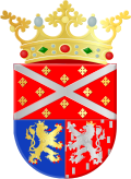
Maasbracht
 From Wikipedia - Reading time: 7 min
Maasbracht | |
|---|---|
Town | |
 St Gertrudis Church | |
| Coordinates: 51°09′N 5°53′E / 51.150°N 5.883°E | |
| Country | Netherlands |
| Province | Limburg |
| Municipality | Maasgouw |
| Area | |
• Total | 10.80 km2 (4.17 sq mi) |
| Elevation | 25 m (82 ft) |
| Population (2021)[1] | |
• Total | 7,050 |
| • Density | 650/km2 (1,700/sq mi) |
| Time zone | UTC+1 (CET) |
| • Summer (DST) | UTC+2 (CEST) |
| Postal code | 6051[1] |
| Dialing code | 0475 |
Maasbracht (Dutch: [maːzˈbrɑxt] ⓘ; Limburgish: Brach [ˈbʀɑx]) is a town in the southeastern Netherlands. It was a separate municipality until 1 January 2007, when it became a part of the new municipality of Maasgouw.
History
[edit]The village was first mentioned in 1265 as "de Bragth", and means "newly cultivated land near the river Maas."[3] Maasbracht developed along the river Maas in the Early Middle Ages. In 1294, it became part of Ambt Montfort. In 1716, it became part of the Dutch Republic.[4]
The Catholic St Gertrudis Church is a long church with double transept. The tower was built in the 14th century. It was severely damaged in 1944, and a new church was built between 1948 and 1949.[4]
Maasbracht was home to 305 people in 1840. In 1934, the Juliana Canal was dug as a bypass for the unnavigable parts of the Maas. The canal transformed Maasbracht in a main harbour and it started to industrialise. Maasbracht has the largest inland harbour of the Netherlands.[5]
It was an independent municipality until 2007 when it was merged into Maasgouw. It is the capital of the municipality of Maasgouw.[5]
Notable people
[edit]- Mark van Bommel (born 1977), football player[6]
Gallery
[edit]-
Sculpture at the roundabout
-
The village near Julianakanaal and the river Maas
-
Harbour of Maasbracht
-
View on Maasbracht
References
[edit]- ^ a b c "Kerncijfers wijken en buurten 2021". Central Bureau of Statistics. Retrieved 25 April 2022.
- ^ "Postcodetool for 6051AA". Actueel Hoogtebestand Nederland (in Dutch). Het Waterschapshuis. Archived from the original on 7 January 2019. Retrieved 25 April 2022.
- ^ "Maasbracht - (geografische naam)". Etymologiebank (in Dutch). Retrieved 25 April 2022.
- ^ a b Sabine Broekhoven, & Ronald Stenvert (2003). Maasbracht (in Dutch). Zwolle: Waanders. ISBN 90 400 9623 6. Retrieved 25 April 2022.
- ^ a b "Maasbracht". Plaatsengids (in Dutch). Retrieved 25 April 2022.
- ^ "Mark van Bommel". World Football. Retrieved 25 April 2022.
 KSF
KSF


