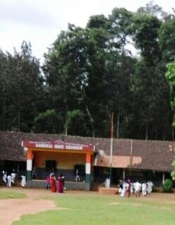
Maldare
 From Wikipedia - Reading time: 4 min
Maldare | |
|---|---|
 | |
| Nickname: Maldare school | |
 | |
| Coordinates: 12°19′19″N 75°56′57″E / 12.32189°N 75.94917°E | |
| Country | |
| State | Karnataka |
| District | Kodagu |
| Time zone | UTC+5:25 (IST) |
| PIN | 571253 |
Maldare is a small village in Kodagu district of Karnataka state, India.
Location
[edit]Maldare is located on the forest road between Piriyapatna and Siddapura. [1]
Distance
[edit]Madikeri, 31 km Virajpet, 26 km Mangalore, 175 km Bangalore, 223 km
Post Office
[edit]There is a post office at Maldare village. The pincode is 571523.[2]
Suburbs and villages
[edit]- Mekur Hosakeri - 12 km
- Nanjarayapatna - 12 km
- Valnur Thyagathur - 12 km
- Thithimathi - 13 km
- Ammathi - 17 km
Demographics
[edit]The village of Maldare has a population of 2,027 and there are a total of 525 houses. The people here speak Kannada, Kodava thakk and Malayalam.[3]
Schools
[edit]Ekalavya Vasathi School Balugodu St Annes School Minority School
- Maldare School
References
[edit]Licensed under CC BY-SA 3.0 | Source: https://en.wikipedia.org/wiki/Maldare49 views | Status: cached on August 16 2025 01:56:34↧ Download as ZWI file
 KSF
KSF