Medchal-Malkajgiri district
 From Wikipedia - Reading time: 8 min
Medchal–Malkajgiri district | |
|---|---|
|
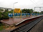
Clockwise from top: Shamirpet Lake, BITS Pilani - Hyderabad Campus, Malkajgiri railway station, Rock formations near Medchal, Cricket stadium at Uppal | |
 Location in Telangana | |
| Country | |
| State | |
| Established | 30 November 2016 |
| Headquarters | Shamirpet |
| Mandalas | 15 |
| Government | |
| • District collector | Sri V. Venkateswarlu, IAS |
| • Parliament constituencies | 1 (Malkajgiri) |
| • Assembly constituencies | 9
Medchal, Malkajgiri, Quthbullapur, Kukatpally, Uppal,Lal Bahadur(L.B) Nagar,Secunderabad Cantt. |
| Area | |
• Total | 1,084 km2 (419 sq mi) |
| Population (2020) | |
• Total | 2,440,073 |
| • Density | 2,300/km2 (5,800/sq mi) |
| • Urban | 2,230,245 (91.40% Urbanized district) |
| Demographics | |
| • Literacy | 82.49 |
| • Sex ratio | 957 |
| Time zone | UTC+05:30 (IST) |
| Vehicle registration | TG–08[1] |
| Major highways | NH-44, NH-65, NH-163 |
| Nominal GDP (2022-23) | ₹88,866.72 crore (US$11 billion) [2] |
| Per Capita Income (2022-23) | ₹295,514 (US$3,500) |
| Website | medchal-malkajgiri |
Medchal−Malkajgiri district is a district in the Indian state of Telangana. Shamirpet is the headquarter of the district.[3][4] It is the second most populous district in the state with a population of 2.5 million and also 91.40% urbanized district in the state of Telangana, standing next only to Hyderabad district which has a population of 4 million. The district shares boundaries with Hyderabad, Medak, Sangareddy, Y. Bhuvanagiri, Siddipet and Rangareddy districts.The most part of the district consist of Hyderabad City (GHMC)
Geography
[edit]The district is spread over an area of 1,084 square kilometres (419 sq mi).It is situated 505 metres above sea level. The landmark consists of rocky terrain and monolithic rocks in the outskirts of the city.[5]
Demographics
[edit]As of 2011[update] census of India, the district is the second most populous district in the state with a population of 2,440,073.[5] Medchal-Malkajgiri has a sex ratio of 957 females per 1000 males and a literacy rate of 82.49%. 285,044 (11.68%) are under 6 years of age. 2,230,245 (91.40%) live in urban areas, the second highest proportion in the state. Scheduled Castes and Scheduled Tribes make up 229,188 (9.39%) and 55,244 (2.26%) of the population respectively.[7]
At the time of the 2011 census, 80.35% of the population spoke Telugu, 8.03% Urdu, 3.94% Hindi, 1.76% Tamil, 1.28% Marathi and 0.92% Lambadi as their first language.[8]
History of District
[edit]The Rangareddy district was formed in 1978 when it was split from Hyderabad district.[9][10] Originally named Hyderabad Rural district, it was renamed after Konda Venkata Ranga Reddy, a freedom fighter who fought for the independence of Telangana from the Nizams and who went on to become the deputy chief minister of Andhra Pradesh.[11] After Telangana State formation in 2014 , it was carved out during the district's reorganisation to create the new Vikarabad district and Medchal–Malkajgiri district.[citation needed]
Administrative divisions
[edit]
The district will have two revenue divisions of Keesara and Malkajgiri. They are sub-divided into 15 mandals.[4] Sri V. Venkateswarlu, IAS is the new collector of the district.
Mandals
[edit]The below table categorizes mandals into their respective revenue divisions in the district:[4]
| # | Malkajgiri revenue division | # | Keesara revenue division |
|---|---|---|---|
| 1 | Alwal | 1 | Ghatkesar |
| 2 | Bachupally | 2 | Kapra |
| 3 | Balanagar | 3 | Keesara |
| 4 | Dundigal Gandimaisamma | 4 | Medchal |
| 5 | Kukatpally | 5 | Medipally |
| 6 | Malkajgiri | 6 | Shamirpet |
| 7 | Quthbullapur | 7 | Uppal |
| 8 | Muduchintalpalli |
Villages
[edit]See also
[edit]References
[edit]- ^ "District Codes". Government of Telangana, Transport Department.
- ^ url=https://www.telangana.gov.in/wp-content/uploads/2024/07/Telangana-Socio-Economic-Outlook-2024.pdf
- ^ "ఘనంగా ఆవిర్భావ సంబురాలు". Retrieved 12 October 2017.
- ^ a b c "Medchal−Malkajgiri district" (PDF). New Districts Formation Portal. Government of Telangana. Archived from the original (PDF) on 30 November 2016. Retrieved 23 March 2017.
- ^ a b "Medchal-Malkajgiri district" (PDF). Official website of Medchal district. Retrieved 20 March 2017.
- ^ "Population by Religion - Andhra Pradesh". Census of India. Registrar General and Census Commissioner of India. 2011.
- ^ "Know your district Plan your district - Medchal-Malkajgiri" (PDF). trac.telangana.gov.in. Telangana State Remote Sensing Applications Centre.
- ^ a b "Table C-16 Population by Mother Tongue: Andhra Pradesh". Census of India. Registrar General and Census Commissioner of India.
- ^ Law, Gwillim (25 September 2011). "Districts of India". Statoids. Retrieved 11 October 2011.
- ^ "Salient Features of Rangareddy District". Rangareddy District Official Website. Collectorate Rangareddy District. Archived from the original on 21 June 2012. Retrieved 19 December 2012.
- ^ "History | RangaReddy District Government of Telangana | India". Retrieved 10 August 2021.
External links
[edit]
 KSF
KSF


