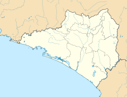
Minatitlán, Colima
 From Wikipedia - Reading time: 7 min
You can help expand this article with text translated from the corresponding article in Spanish. (August 2012) Click [show] for important translation instructions.
|
Minatitlán | |
|---|---|
| Coordinates: 19°23′N 104°3′W / 19.383°N 104.050°W | |
| Country | |
| State | Colima |
| Municipality | Minatitlán |
| Government | |
| • Municipal president | Héctor Bautista Vázquez[1] (PRI[2]) |
| Population (1995) | |
• Total | 4,009 |
| Time zone | UTC-6 (CST) |
| • Summer (DST) | UTC-5 (CDT) |
| Website | (in Spanish) Ayuntamiento de Minatitlán, Colima |
| Source: Enciclopedia de los Municipios de México | |
Minatitlán is a town in the Mexican state of Colima. It serves as the municipal seat of the surrounding Minatitlán Municipality.[3]
Economy
[edit]Minatitlán has a significant agricultural economy. The main crops grown include coffee beans, corn, mangos, green tomatoes, rice, jalapeños, oranges, sugar cane, mamey sapote, and other fruit trees. There's also a large iron mine located at the Astilla mount, named "Peña Colorada".[citation needed]
References
[edit]- ^ (in Spanish) Cuautitlán y Minatitlán; en conflicto por un puente[usurped], Casimiro Castillo, El Sur, June 22, 2007. Accessed on line December 28, 2007.
- ^ (in Spanish) De acuerdo al PREP, aventaja PRI-PVEM en 8 alcaldías y 2 el PAN, el Comentario, July 3, 2006. Accessed on line December 28, 2007.
- ^ (in Spanish) Minatitlán, Colima Archived 2008-03-13 at the Wayback Machine at the Enciclopedia de los Municipios de México. Accessed on line December 28, 2007.
External links
[edit]- (in Spanish) Minatitlán, Colima Enciclopedia de los Municipios de México, INAFED
- (in Spanish) Ayuntamiento de Minatitlan, Colima, Mexico municipal government website.
Licensed under CC BY-SA 3.0 | Source: https://en.wikipedia.org/wiki/Minatitlán,_Colima16 views | Status: cached on May 03 2025 18:43:33↧ Download as ZWI file
 KSF
KSF


