Categories
Nepaug State Forest
 From Wikipedia - Reading time: 8 min
| Nepaug State Forest | |
|---|---|
 Nepaug State Forest's Valley Outlook Trail scenic overlook view of the Nepaug valley and Yellow Mountain. | |
 Location in Connecticut  Nepaug State Forest (the United States) | |
| Location | Litchfield, Connecticut, United States |
| Coordinates | 41°50′16″N 72°57′27″W / 41.83778°N 72.95750°W[1] |
| Area | 1,373 acres (5.56 km2)[2] |
| Elevation | 581 ft (177 m)[1] |
| Established | 1942 [3] |
| Governing body | Connecticut Department of Energy and Environmental Protection |
| Website | Nepaug State Forest |
Nepaug State Forest is a Connecticut state forest located primarily in the town of New Hartford.[4]
Recreation opportunities
[edit]The forest offers hiking, biking, cross-country skiing, fishing, camping, letterboxing, and hunting. Trails that cross the forest include the blue-blazed Tunxis Trail.
Image gallery
[edit]-
 Nepaug State Forest's "Tunxis Trail" dirt road main entrance off CT-202 and parking lot.
 -
 Nepaug State Forest's backpacking camping area—rock campfire ring and very rustic log bench.
 -
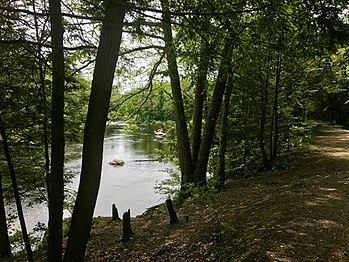 Farmington River Bank And River Road In Nepaug State Forest.
 -
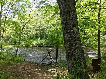 Farmington River Bank fishing spot in Nepaug State Forest.


References
[edit]- ^ a b "Nepaug State Forest". Geographic Names Information System. United States Geological Survey, United States Department of the Interior.
- ^ Legislative Program Review and Investigations Committee (January 23, 2014). "State Parks and Forests: Funding" (PDF). Staff Findings and Recommendations. Connecticut General Assembly. p. A-3. Retrieved March 20, 2014.
- ^ "Connecticut State Forests Seedling Letterbox Series - Clues for Nepaug State Forest". State Parks and Forests. Connecticut Department of Energy and Environmental Protection. Retrieved July 21, 2014.
- ^ "Nepaug State Forest". State Parks and Forests. Connecticut Department of Energy and Environmental Protection. Retrieved July 21, 2014.
External links
[edit]Wikimedia Commons has media related to Nepaug State Forest.
- Nepaug State Forest Connecticut Department of Energy and Environmental Protection
- Nepaug State Forest Camping Map Connecticut Department of Energy and Environmental Protection
Licensed under CC BY-SA 3.0 | Source: https://en.wikipedia.org/wiki/Nepaug_State_Forest39 views | Status: cached on March 23 2025 02:03:17↧ Download as ZWI file
 EncycloReader
is supported by the
EncycloReader
is supported by the