Categories
Pierpont, Monongalia County, West Virginia
 From Wikipedia - Reading time: 6 min
Pierpont, West Virginia | |
|---|---|
 Pierpont, West Virginia  Pierpont, West Virginia | |
| Coordinates: 39°39′14″N 79°53′22″W / 39.65389°N 79.88944°W | |
| Country | |
| State | |
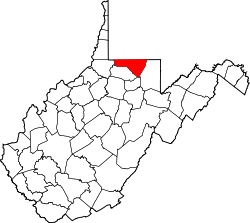
| County | |
| Elevation | 380 m (1,247 ft) |
| Time zone | UTC-5 (Eastern (EST)) |
| • Summer (DST) | UTC-4 (EDT) |
| Area code(s) | 304 & 681 |
| GNIS feature ID | 1544807[1] |
Pierpont is an unincorporated community in Monongalia County, West Virginia, United States. Pierpont is located on County Route 67 near Interstate 68, 3.9 miles (6.3 km) east-northeast of Morgantown.[2]
References
[edit]- ^ U.S. Geological Survey Geographic Names Information System: Pierpont, Monongalia County, West Virginia
- ^ Monongalia County, West Virginia General Highway Map (PDF) (Map). West Virginia Department of Transportation. 2011. p. 1. Archived from the original (PDF) on April 25, 2012. Retrieved October 17, 2011.
This article about a location in Monongalia County, West Virginia is a stub. You can help Wikipedia by expanding it. |
Licensed under CC BY-SA 3.0 | Source: https://en.wikipedia.org/wiki/Pierpont,_Monongalia_County,_West_Virginia1 | Status: cached on April 05 2025 11:47:08↧ Download as ZWI file
 EncycloReader
is supported by the
EncycloReader
is supported by the