Ponta do Sol, Cape Verde
 From Wikipedia - Reading time: 7 min
Ponta do Sol | |
|---|---|
Settlement | |
 View of Ponta do Sol | |
| Coordinates: 17°12′07″N 25°05′35″W / 17.202°N 25.093°W | |
| Country | Cape Verde |
| Island | Santo Antão |
| Municipality | Ribeira Grande |
| Civil parish | Nossa Senhora do Livramento |
| Elevation | 49 m (161 ft) |
| Population (2010)[1] | |
• Total | 2,143 |
| Postal code | 1120 |
| ID | 11202 |
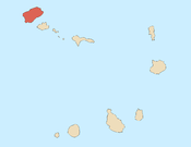
Ponta do Sol (formerly: Vila Dona Maria Pia) is the northernmost city[2] on the island of Santo Antão and Cape Verde. It is situated on the coast, 4 km northwest of Ribeira Grande and 20 km north of the island capital Porto Novo. It is the seat of Ribeira Grande municipality.


Ponta do Sol is divided into the neighbourhoods Casinhas, Cavouquinho das Tintas, Chã de Cemitério, Chã de Ponta do Sol, Lombinho, Lombo da Cruz, Lombo de Paço, Os Órgãos, Ponta do Sol and Ribeira da Ponta do Sol.
Ponta do Sol takes its name from the nearby headland Ponta do Sol, the northernmost point of Cape Verde. The former name Vila Dona María Pia refers to Maria Pia of Savoy, queen of Portugal between 1862 and 1889. Urban development of Ponta do Sol started in the 1880s; before, it was a small fishing village.[3]: 25 The church Nossa Senhora do Livramento was built in 1894.[3]: 37–38 There is a Jewish cemetery in the town.[3]: 52–53
Historical population
[edit]| Year | Population |
|---|---|
| 1990 (Census)[4] | 1,505 |
| 2010 (Census)[1] | 2,143 |
Notable people
[edit]- Jorge Ferreira Chaves, Portuguese architect
- Raul Pires Ferreira Chaves, Portuguese worker
See also
[edit]References
[edit]- ^ a b "2010 Census results". Instituto Nacional de Estatística Cabo Verde (in Portuguese). 24 November 2016.
- ^ Cabo Verde, Statistical Yearbook 2015, Instituto Nacional de Estatística, p. 32-33
- ^ a b c Revitalização dos patrimónios arquitectónicos da cidade da Ponta do Sol, António Carlos Oliveira Lopes, 2012
- ^ Cape Verde, www.citypopulation.de
External links
[edit] Media related to Ponta do Sol (Cape Verde) at Wikimedia Commons
 KSF
KSF
