Categories
Rosefield Township, Peoria County, Illinois
 From Wikipedia - Reading time: 7 min
Rosefield Township | |
|---|---|
Township | |
 Location in Peoria County | |
 Peoria County's location in Illinois | |
| Country | United States |
| State | Illinois |
| County | Peoria |
| Established | November 6, 1849 |
| Area | |
• Total | 36.53 sq mi (94.6 km2) |
| • Land | 36.38 sq mi (94.2 km2) |
| • Water | 0.15 sq mi (0.4 km2) 0.41% |
| Population (2010) | |
• Estimate (2016)[1] | 1,210 |
| • Density | 33.5/sq mi (12.9/km2) |
| Time zone | UTC-6 (CST) |
| • Summer (DST) | UTC-5 (CDT) |
| FIPS code | 17-143-65715 |
Rosefield Township is located in Peoria County, Illinois. At the 2010 census, its population was 1,217 and it contained 489 housing units.[2]
Geography
[edit]According to the 2010 census, the township has a total area of 36.53 square miles (94.6 km2), of which 36.38 square miles (94.2 km2) (or 99.59%) is land and 0.15 square miles (0.39 km2) (or 0.41%) is water.[2]
Demographics
[edit]| Census | Pop. | Note | %± |
|---|---|---|---|
| 2016 (est.) | 1,210 | [1] | |
| U.S. Decennial Census[3] | |||
References
[edit]- ^ a b "Population and Housing Unit Estimates". Retrieved June 9, 2017.
- ^ a b "Population, Housing Units, Area, and Density: 2010 - County -- County Subdivision and Place -- 2010 Census Summary File 1". United States Census. Archived from the original on February 12, 2020. Retrieved May 28, 2013.
- ^ "Census of Population and Housing". Census.gov. Retrieved June 4, 2016.
External links
[edit]Municipalities and communities of Peoria County, Illinois, United States | ||
|---|---|---|
| Cities | 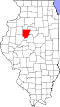 | |
| Villages | ||
| Townships | ||
| CDPs | ||
| Other communities | ||
| Footnotes | ‡This populated place also has portions in an adjacent county or counties | |
40°44′58″N 89°49′04″W / 40.74944°N 89.81778°W
This Peoria County, Illinois location article is a stub. You can help Wikipedia by expanding it. |
Licensed under CC BY-SA 3.0 | Source: https://en.wikipedia.org/wiki/Rosefield_Township,_Peoria_County,_Illinois1 | Status: cached on April 26 2025 22:31:54↧ Download as ZWI file
 EncycloReader
is supported by the
EncycloReader
is supported by the