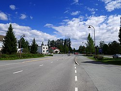
Soini, Finland
 From Wikipedia - Reading time: 6 min
Soini | |
|---|---|
Municipality | |
| Soinin kunta Soini kommun | |
 | |
 Location of Soini in Finland | |
| Coordinates: 62°52.5′N 24°12.5′E / 62.8750°N 24.2083°E | |
| Country | |
| Region | Southern Ostrobothnia |
| Sub-region | Järviseutu |
| Charter | 1868 |
| Government | |
| • Municipal manager | Maija Pihlajamäki |
| Area (2018-01-01)[1] | |
• Total | 574.22 km2 (221.71 sq mi) |
| • Land | 551.95 km2 (213.11 sq mi) |
| • Water | 22.17 km2 (8.56 sq mi) |
| • Rank | 155th largest in Finland |
| Population (2025-03-31)[2] | |
• Total | 1,799 |
| • Rank | 264th largest in Finland |
| • Density | 3.26/km2 (8.4/sq mi) |
| Population by native language | |
| • Finnish | 98.6% (official) |
| • Others | 1.4% |
| Population by age | |
| • 0 to 14 | 15.6% |
| • 15 to 64 | 52.3% |
| • 65 or older | 32.1% |
| Time zone | UTC+02:00 (EET) |
| • Summer (DST) | UTC+03:00 (EEST) |
| Website | www.soini.fi |
Soini is a municipality of Finland. It is located in the Southern Ostrobothnia region. The municipality has a population of 1,799 (31 March 2025)[2] and covers an area of 574.22 square kilometres (221.71 sq mi) of which 22.17 km2 (8.56 sq mi) is water.[1] The population density is 3.26 inhabitants per square kilometre (8.4/sq mi).
Neighbouring municipalities are Alajärvi, Karstula, Kyyjärvi, Saarijärvi and Ähtäri.
The municipality is unilingually Finnish.
History
[edit]The name is derived from the male name Soini, a Finnish variant of the Scandinavian name Sven. The village was first mentioned in 1754 as a part of the Alajärvi parish. Soini gained a chapel in 1784 and a church in 1859. It was fully separated from Alajärvi in 1895. Soini originally had a Swedish name, Konungsåby, which referred to the river Kuninkaanjoki.[6]
People born in Soini
[edit]- Aukusti Mäenpää (1891 – 1933)
- Eino Uusitalo (1924 – 2015)
- Pekka Pesola (1925 – 2009)
- Jorma Huuhtanen (1945 – )
- Aulis Akonniemi (1958 – )
- Merja Korpela (1981 – )
- Noora Hautakangas (1984 – )
References
[edit]- ^ a b "Area of Finnish Municipalities 1.1.2018" (PDF). National Land Survey of Finland. Retrieved 30 January 2018.
- ^ a b "Finland's preliminary population figure was 5,640,437 at the end of March 2025". Population structure. Statistics Finland. 2025-04-25. ISSN 1797-5395. Retrieved 2025-04-25.
- ^ "Number of foreign-language speakers exceeded 600,000 during 2024". Population structure. Statistics Finland. 2025-04-04. ISSN 1797-5395. Retrieved 2025-04-05.
- ^ "Population according to age (1-year) and sex by area and the regional division of each statistical reference year, 2003–2020". StatFin. Statistics Finland. Retrieved 2 May 2021.
- ^ a b "Luettelo kuntien ja seurakuntien tuloveroprosenteista vuonna 2023". Tax Administration of Finland. 14 November 2022. Retrieved 7 May 2023.
- ^ "SuomalainenPaikannimikirja_e-kirja_kuvallinen.pdf" (PDF). kaino.kotus.fi (in Finnish). p. 419. Retrieved October 13, 2022.
External links
[edit]![]() Media related to Soini at Wikimedia Commons
Media related to Soini at Wikimedia Commons
- Municipality of Soini – Official website
 KSF
KSF
