Stepan
 From Wikipedia - Reading time: 7 min
Stepan
Степань | |
|---|---|
 Holy Trinity Church | |
| Coordinates: 51°07′42″N 26°18′15″E / 51.12833°N 26.30417°E | |
| Country | |
| Oblast | Rivne Oblast |
| Raion | Sarny Raion |
| Hromada | Stepan settlement hromada |
| Founded | 1861 |
| Town status | 1980 |
| Government | |
| • Town Head | Volodymyr Sydorchuk |
| Area | |
• Total | 3.33 km2 (1.29 sq mi) |
| Elevation | 164 m (538 ft) |
| Population (2001) | |
• Total | 4,073 |
| • Density | 1,200/km2 (3,200/sq mi) |
| Time zone | UTC+2 (EET) |
| • Summer (DST) | UTC+3 (EEST) |
| Postal code | 34560 |
| Area code | +380 3655 |
| Website | http://rada.gov.ua/ |
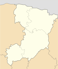
Stepan (Ukrainian: Степань; Polish: Stepań; Hebrew: סטפאן) is a rural settlement in Sarny Raion (district) of Rivne Oblast (province) in western Ukraine. Its population was 4,073 as of the 2001 Ukrainian Census.[2] Current population: 4,062 (2022 estimate)[3]
The settlement is located in the historic Volhynia region of Ukraine, on the left bank of the Horyn, a tributary of the Prypiat.[4]
History
[edit]The first written mention of Stepan dates back to 1290.[2] In 1900, the Jewish population of Stepan totaled 1,854.[5] During the World War II occupation of Ukraine, the Nazi German occupying forces established a Jewish ghetto, where nearly 3000 Jews were killed.[4] In 1960, Stepan acquired the status of an urban-type settlement.[2] On 26 January 2024, a new law entered into force which abolished this status, and Stepan became a rural settlement.[6]
People from Stepan
[edit]- Stanisław Gabriel Worcell (1799–1857), socialist Polish revolutionary[7]
See also
[edit]- Klesiv, the other former urban-type settlement in Sarny Raion of Rivne Oblast
References
[edit]- ^ "Stepan (Rivne Oblast, Sarny Raion)". weather.in.ua. Retrieved 9 February 2012.
- ^ a b c "Stepan, Rivne Oblast, Sarny Raion". Regions of Ukraine and their Structure (in Ukrainian). Verkhovna Rada of Ukraine. Archived from the original on 21 April 2016. Retrieved 9 February 2012.
- ^ Чисельність наявного населення України на 1 січня 2022 [Number of Present Population of Ukraine, as of January 1, 2022] (PDF) (in Ukrainian and English). Kyiv: State Statistics Service of Ukraine. Archived (PDF) from the original on 4 July 2022.
- ^ a b "Stepan". Castles and Churches of Ukraine (in Ukrainian). Retrieved 9 February 2012.
- ^ "Stepan, Ukraine". JewishGen. Retrieved 10 February 2012.
- ^ "Что изменится в Украине с 1 января". glavnoe.in.ua (in Russian). 1 January 2024.
- ^ "Stanisław Gabriel Worcell (1799–1857)". Kalendarz Historyczny (in Polish). Retrieved 9 February 2012.
External links
[edit] Media related to Category:Stepań at Wikimedia Commons
 KSF
KSF


